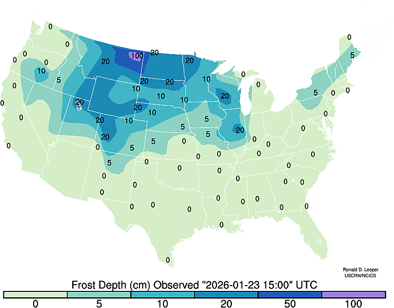
Contours are not rendered during times of limited data coverage (i.e. soil moisture fields during winter). Shaded contours, when available,
provide a regional perspective, but may not accurately reflect conditions in areas separated from USCRN stations by distance and/or
topography (elevation/land cover). Figures update hourly and represent most recent conditions (three-hours-ago due to timing of satellite transmissions).
If communications are down figures may not update. Coordinated Universal Time (UTC) is used for consistency.