1929
Tropical Depression UNNAMED (1929041S19056)
IBTrACS version v04r01. Visit
IBTrACS website for data access.
Please direct all questions to the
IBTrACS Q and A forum
Storm track
-
Intensity
-
Wind Radii
-
Intensity Data
-
Source Data
-
All data
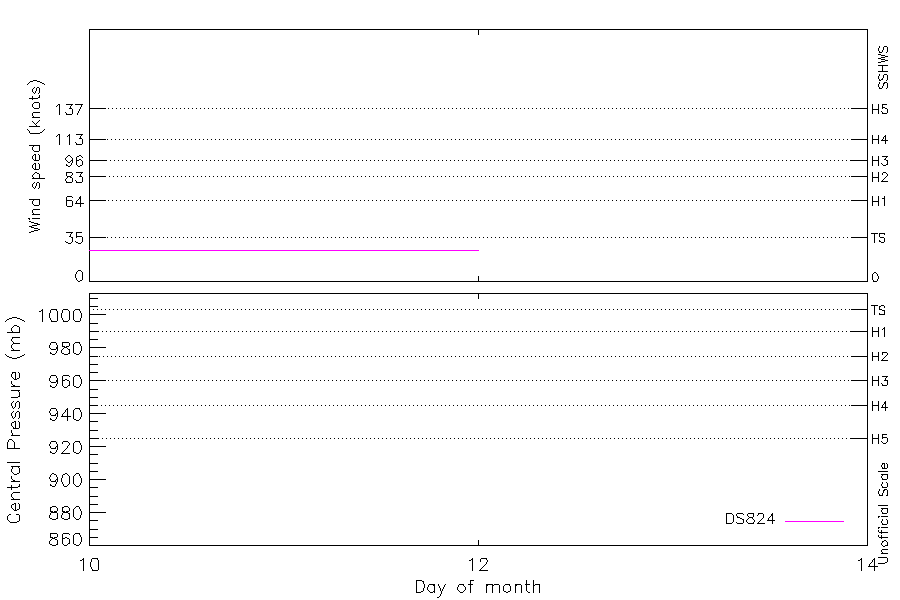
Summary Information
|
|
| Storm ID |
1929041S19056 |
| Start |
Feb 10 00Z |
| Max Intensity |
25 kt (Feb 10 03Z) |
| End |
Feb 12 00Z |
| ATCF IDs |
|
| Track status |
Best track data. |
|
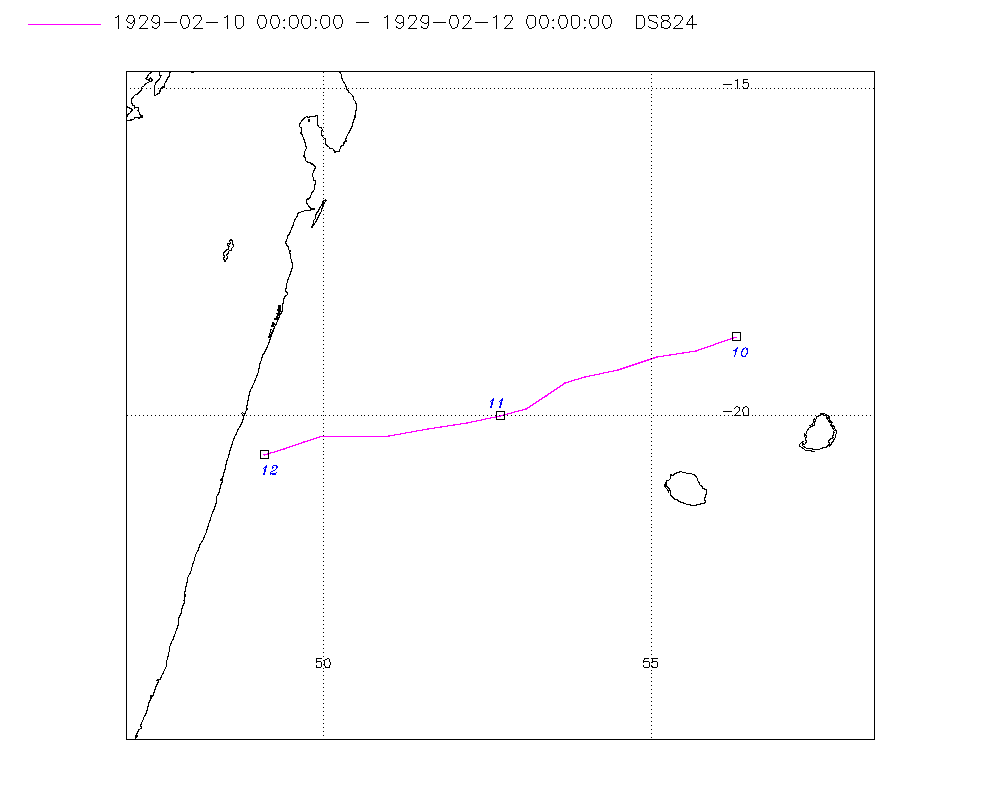
Storm track plot
|
Intensity plots
|
Radial wind information
No radial wind information for this storm
|
Position and Intensity Table
| BASIN |
ISO_TIME_________ |
NATURE |
LAT |
LON |
DS824 WIND |
| |
|
|
degrees north |
degrees east |
kts |
| SI |
1929-02-10 00:00:00 |
TS |
-18.80 |
56.30 |
25 |
| SI |
03:00:00 |
TS |
-19.00 |
55.70 |
25 |
| SI |
06:00:00 |
TS |
-19.10 |
55.10 |
25 |
| SI |
09:00:00 |
TS |
-19.30 |
54.50 |
25 |
| SI |
12:00:00 |
TS |
-19.40 |
54.00 |
25 |
| SI |
15:00:00 |
TS |
-19.50 |
53.70 |
25 |
| SI |
18:00:00 |
TS |
-19.70 |
53.40 |
25 |
| SI |
21:00:00 |
TS |
-19.90 |
53.10 |
25 |
| SI |
1929-02-11 00:00:00 |
TS |
-20.00 |
52.70 |
25 |
| SI |
03:00:00 |
TS |
-20.10 |
52.20 |
25 |
| SI |
06:00:00 |
TS |
-20.20 |
51.60 |
25 |
| SI |
09:00:00 |
TS |
-20.30 |
51.00 |
25 |
| SI |
12:00:00 |
TS |
-20.30 |
50.40 |
25 |
| SI |
15:00:00 |
TS |
-20.30 |
50.00 |
25 |
| SI |
18:00:00 |
TS |
-20.40 |
49.70 |
25 |
| SI |
21:00:00 |
TS |
-20.50 |
49.40 |
25 |
| SI |
1929-02-12 00:00:00 |
TS |
-20.60 |
49.10 |
25 |
Source Information
| Agency |
Information |
| USA |
|
| TOKYO |
|
| CMA |
|
| HKO |
|
| KMA |
|
| NEWDELHI |
|
| REUNION |
|
| BOM |
|
| NADI |
|
| WELLINGTON |
|
| DS824 |
s_hem.dat:280:NOT NAMED |
| TD9636 |
|
| TD9635 |
|
| NEUMANN |
|
| MLC |
|
All available IBTrACS Data
| SEASON |
BASIN |
SUBBASIN |
ISO_TIME_________ |
NATURE |
LAT |
LON |
DIST2LAND |
LANDFALL |
IFLAG |
USA SSHS |
DS824 LAT |
DS824 LON |
DS824 STAGE |
DS824 WIND |
STORM SPEED |
STORM DIR |
| Year |
|
|
|
|
degrees north |
degrees east |
km |
km |
|
1 |
degrees north |
degrees east |
|
kts |
kts |
degrees |
| 1929 |
SI |
MM |
1929-02-10 00:00:00 |
TS |
-18.80 |
56.30 |
192 |
192 |
__________O____ |
-5 |
-18.80 |
56.30 |
TC |
25 |
12 |
255 |
| 1929 |
SI |
MM |
03:00:00 |
TS |
-19.00 |
55.70 |
223 |
212 |
__________P____ |
-5 |
-19.00 |
55.70 |
TC |
25 |
12 |
255 |
| 1929 |
SI |
MM |
06:00:00 |
TS |
-19.10 |
55.10 |
213 |
205 |
__________O____ |
-5 |
-19.10 |
55.10 |
TC |
25 |
12 |
255 |
| 1929 |
SI |
MM |
09:00:00 |
TS |
-19.30 |
54.50 |
207 |
207 |
__________P____ |
-5 |
-19.30 |
54.50 |
TC |
25 |
11 |
255 |
| 1929 |
SI |
MM |
12:00:00 |
TS |
-19.40 |
54.00 |
224 |
222 |
__________O____ |
-5 |
-19.40 |
54.00 |
TC |
25 |
8 |
250 |
| 1929 |
SI |
MM |
15:00:00 |
TS |
-19.50 |
53.70 |
236 |
228 |
__________P____ |
-5 |
-19.50 |
53.70 |
TC |
25 |
6 |
240 |
| 1929 |
SI |
MM |
18:00:00 |
TS |
-19.70 |
53.40 |
244 |
244 |
__________O____ |
-5 |
-19.70 |
53.40 |
TC |
25 |
6 |
240 |
| 1929 |
SI |
MM |
21:00:00 |
TS |
-19.90 |
53.10 |
256 |
256 |
__________P____ |
-5 |
-19.90 |
53.10 |
TC |
25 |
7 |
245 |
| 1929 |
SI |
MM |
1929-02-11 00:00:00 |
TS |
-20.00 |
52.70 |
287 |
287 |
__________O____ |
-5 |
-20.00 |
52.70 |
TC |
25 |
9 |
255 |
| 1929 |
SI |
MM |
03:00:00 |
TS |
-20.10 |
52.20 |
331 |
293 |
__________P____ |
-5 |
-20.10 |
52.20 |
TC |
25 |
11 |
260 |
| 1929 |
SI |
MM |
06:00:00 |
TS |
-20.20 |
51.60 |
293 |
232 |
__________O____ |
-5 |
-20.20 |
51.60 |
TC |
25 |
12 |
265 |
| 1929 |
SI |
MM |
09:00:00 |
TS |
-20.30 |
51.00 |
232 |
170 |
__________P____ |
-5 |
-20.30 |
51.00 |
TC |
25 |
11 |
265 |
| 1929 |
SI |
MM |
12:00:00 |
TS |
-20.30 |
50.40 |
170 |
129 |
__________O____ |
-5 |
-20.30 |
50.40 |
TC |
25 |
9 |
265 |
| 1929 |
SI |
MM |
15:00:00 |
TS |
-20.30 |
50.00 |
129 |
104 |
__________P____ |
-5 |
-20.30 |
50.00 |
TC |
25 |
7 |
260 |
| 1929 |
SI |
MM |
18:00:00 |
TS |
-20.40 |
49.70 |
104 |
80 |
__________O____ |
-5 |
-20.40 |
49.70 |
TC |
25 |
6 |
255 |
| 1929 |
SI |
MM |
21:00:00 |
TS |
-20.50 |
49.40 |
80 |
56 |
__________P____ |
-5 |
-20.50 |
49.40 |
TC |
25 |
6 |
250 |
| 1929 |
SI |
MM |
1929-02-12 00:00:00 |
TS |
-20.60 |
49.10 |
56 |
|
__________O____ |
-5 |
-20.60 |
49.10 |
TC |
25 |
6 |
250 |