1984
Tropical Storm HOLLY (1984236N42146)
IBTrACS version v04r01. Visit
IBTrACS website for data access.
Please direct all questions to the
IBTrACS Q and A forum
Storm track
-
Intensity
-
Wind Radii
-
Intensity Data
-
Source Data
-
All data
Summary Information
|
| Storm ID |
1984236N42146 |
| Start |
Aug 23 00Z |
| Max Intensity |
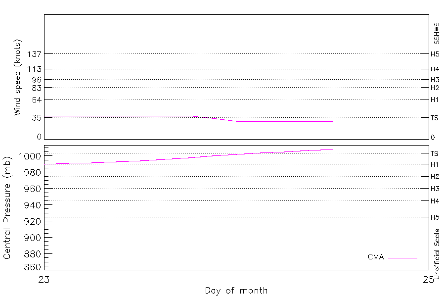
38 kt (Aug 23 03Z) |
| End |
Aug 24 12Z |
| ATCF IDs |
|
| Track status |
Best track data. |
|
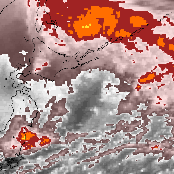
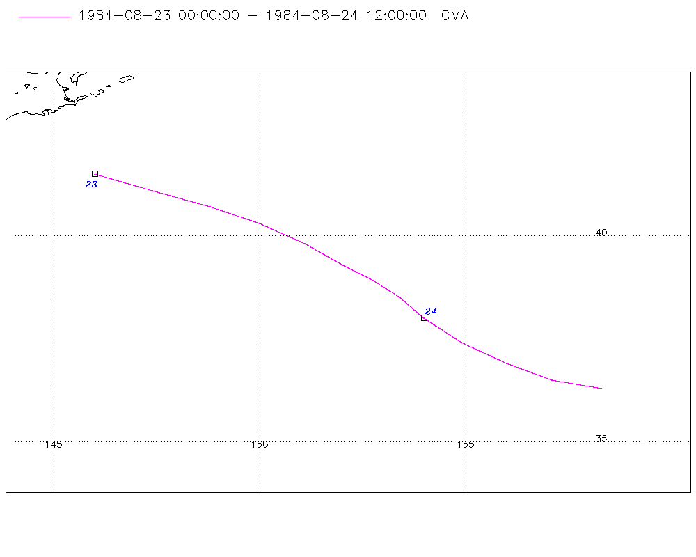
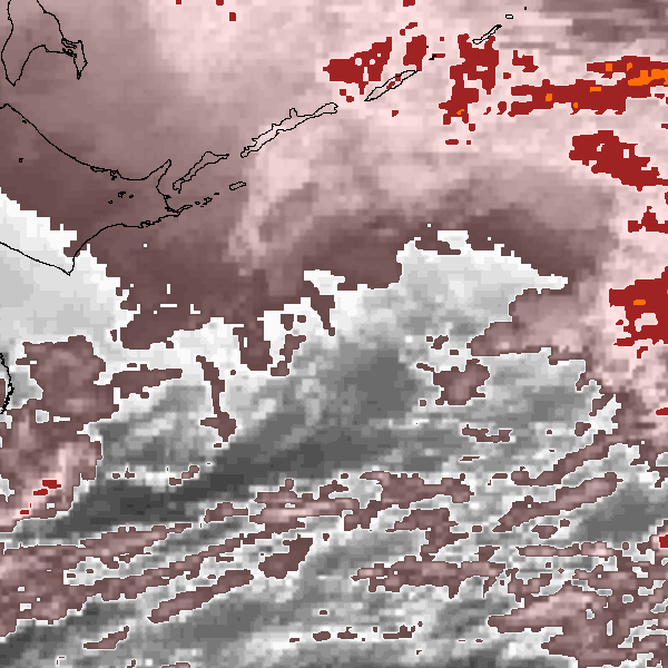
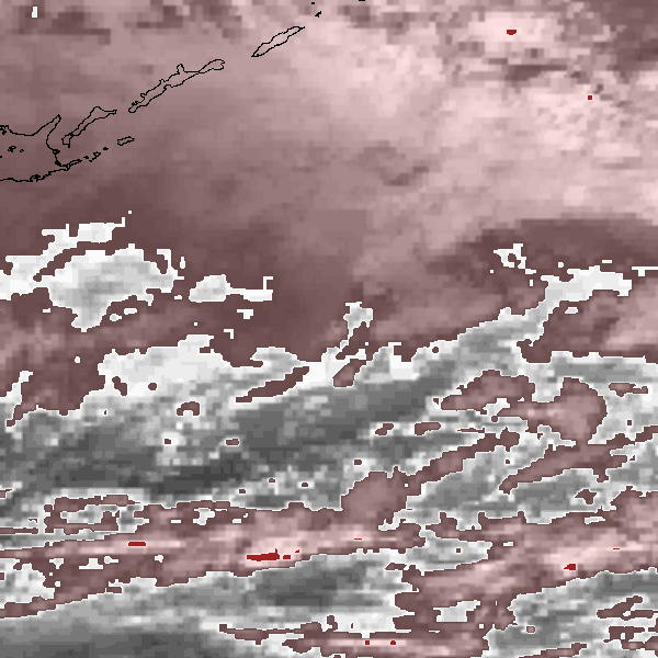
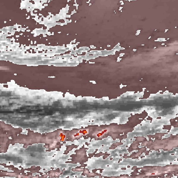
Storm track plot
|
Intensity plots
|
Radial wind information
No radial wind information for this storm
|
Position and Intensity Table
| BASIN |
ISO_TIME_________ |
NATURE |
LAT |
LON |
CMA WIND |
CMA PRES |
| |
|
|
degrees north |
degrees east |
kts |
mb |
| WP |
1984-08-23 00:00:00 |
TS |
41.50 |
146.00 |
38 |
990 |
| WP |
03:00:00 |
TS |
41.10 |
147.40 |
38 |
991 |
| WP |
06:00:00 |
TS |
40.70 |
148.80 |
38 |
992 |
| WP |
09:00:00 |
TS |
40.30 |
150.00 |
38 |
993 |
| WP |
12:00:00 |
TS |
39.80 |
151.10 |
38 |
994 |
| WP |
15:00:00 |
TS |
39.30 |
152.00 |
38 |
996 |
| WP |
18:00:00 |
TS |
38.90 |
152.80 |
38 |
998 |
| WP |
21:00:00 |
TS |
38.50 |
153.40 |
34 |
1000 |
| WP |
1984-08-24 00:00:00 |
TS |
38.00 |
154.00 |
29 |
1002 |
| WP |
03:00:00 |
TS |
37.40 |
154.90 |
29 |
1004 |
| WP |
06:00:00 |
TS |
36.90 |
156.00 |
29 |
1005 |
| WP |
09:00:00 |
TS |
36.50 |
157.10 |
29 |
1007 |
| WP |
12:00:00 |
TS |
36.30 |
158.30 |
29 |
1008 |
Source Information
| Agency |
Information |
| USA |
|
| TOKYO |
|
| CMA |
CH1984BST.txt:Storm=13:Holly(-)1 |
| HKO |
|
| KMA |
|
| NEWDELHI |
|
| REUNION |
|
| BOM |
|
| NADI |
|
| WELLINGTON |
|
| DS824 |
|
| TD9636 |
|
| TD9635 |
|
| NEUMANN |
|
| MLC |
|
All available IBTrACS Data
| SEASON |
BASIN |
SUBBASIN |
ISO_TIME_________ |
NATURE |
LAT |
LON |
DIST2LAND |
LANDFALL |
IFLAG |
USA SSHS |
CMA LAT |
CMA LON |
CMA CAT |
CMA WIND |
CMA PRES |
STORM SPEED |
STORM DIR |
| Year |
|
|
|
|
degrees north |
degrees east |
km |
km |
|
1 |
degrees north |
degrees east |
1 |
kts |
mb |
kts |
degrees |
| 1984 |
WP |
MM |
1984-08-23 00:00:00 |
TS |
41.50 |
146.00 |
184 |
184 |
__O____________ |
-5 |
41.50 |
146.00 |
2 |
38 |
990 |
23 |
110 |
| 1984 |
WP |
MM |
03:00:00 |
TS |
41.10 |
147.40 |
280 |
280 |
__P____________ |
-5 |
41.10 |
147.40 |
2 |
38 |
991 |
23 |
110 |
| 1984 |
WP |
MM |
06:00:00 |
TS |
40.70 |
148.80 |
388 |
388 |
__O____________ |
-5 |
40.70 |
148.80 |
2 |
38 |
992 |
21 |
115 |
| 1984 |
WP |
MM |
09:00:00 |
TS |
40.30 |
150.00 |
492 |
492 |
__P____________ |
-5 |
40.30 |
150.00 |
2 |
38 |
993 |
20 |
115 |
| 1984 |
WP |
MM |
12:00:00 |
TS |
39.80 |
151.10 |
599 |
599 |
__O____________ |
-5 |
39.80 |
151.10 |
2 |
38 |
994 |
18 |
120 |
| 1984 |
WP |
MM |
15:00:00 |
TS |
39.30 |
152.00 |
693 |
693 |
__P____________ |
-5 |
39.30 |
152.00 |
2 |
38 |
996 |
16 |
125 |
| 1984 |
WP |
MM |
18:00:00 |
TS |
38.90 |
152.80 |
774 |
774 |
__O____________ |
-5 |
38.90 |
152.80 |
2 |
38 |
998 |
14 |
130 |
| 1984 |
WP |
MM |
21:00:00 |
TS |
38.50 |
153.40 |
843 |
843 |
__P____________ |
-5 |
38.50 |
153.40 |
2 |
34 |
1000 |
13 |
135 |
| 1984 |
WP |
MM |
1984-08-24 00:00:00 |
TS |
38.00 |
154.00 |
916 |
916 |
__O____________ |
-5 |
38.00 |
154.00 |
1 |
29 |
1002 |
16 |
130 |
| 1984 |
WP |
MM |
03:00:00 |
TS |
37.40 |
154.90 |
1008 |
1008 |
__P____________ |
-5 |
37.40 |
154.90 |
1 |
29 |
1004 |
19 |
125 |
| 1984 |
WP |
MM |
06:00:00 |
TS |
36.90 |
156.00 |
1100 |
1100 |
__O____________ |
-5 |
36.90 |
156.00 |
1 |
29 |
1005 |
20 |
115 |
| 1984 |
WP |
MM |
09:00:00 |
TS |
36.50 |
157.10 |
1185 |
1185 |
__P____________ |
-5 |
36.50 |
157.10 |
1 |
29 |
1007 |
19 |
110 |
| 1984 |
WP |
MM |
12:00:00 |
TS |
36.30 |
158.30 |
1258 |
|
__O____________ |
-5 |
36.30 |
158.30 |
1 |
29 |
1008 |
19 |
105 |