1998
Tropical Cyclone (Storm) UNNAMED (1998355S20210)
IBTrACS version v04r01. Visit
IBTrACS website for data access.
Please direct all questions to the
IBTrACS Q and A forum
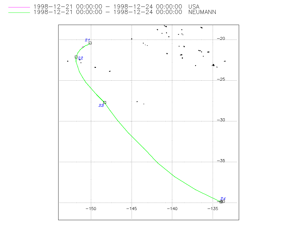
Storm track
-
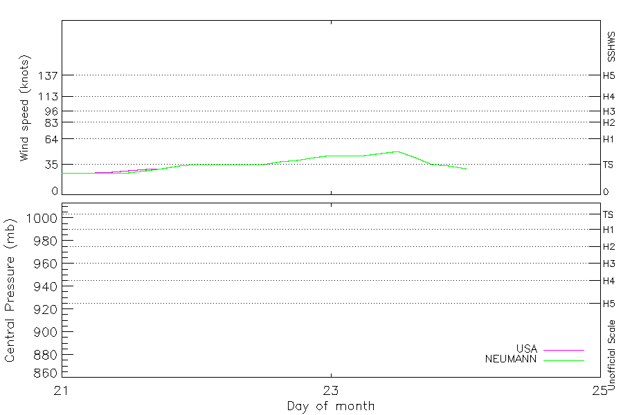
Intensity
-
Wind Radii
-
Intensity Data
-
Source Data
-
All data
Summary Information
|
| Storm ID |
1998355S20210 |
| Start |
Dec 21 00Z |
| Max Intensity |
50 kt (Dec 23 12Z) |
| End |
Dec 24 00Z |
| ATCF IDs |
SH081999 |
| Track status |
Best track data. |
|
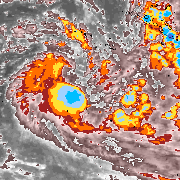
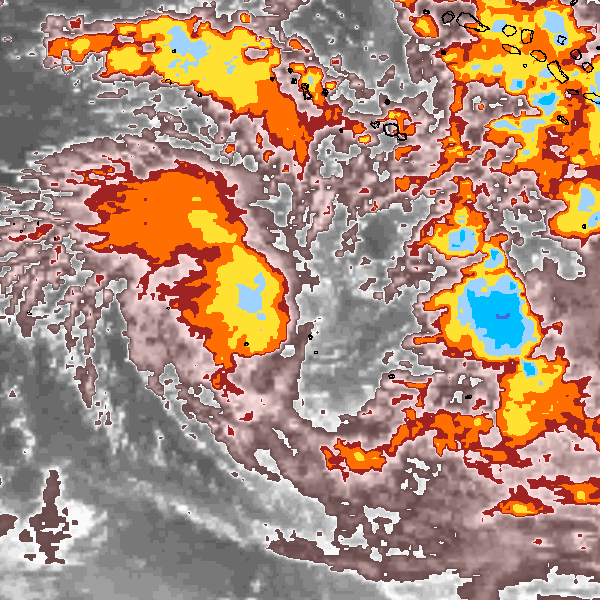
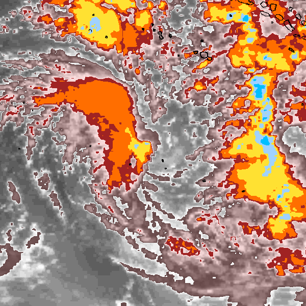
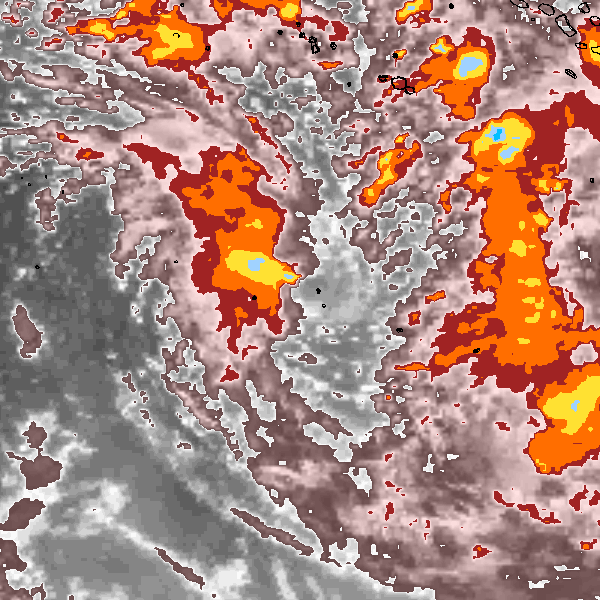
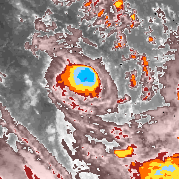
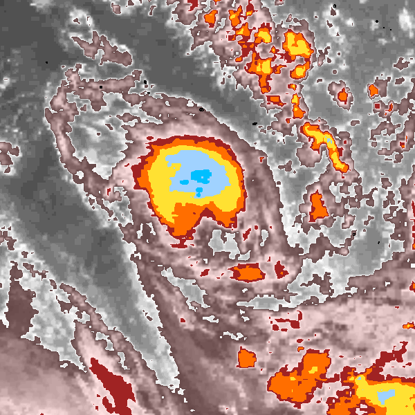
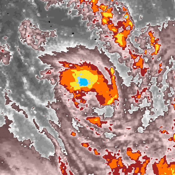
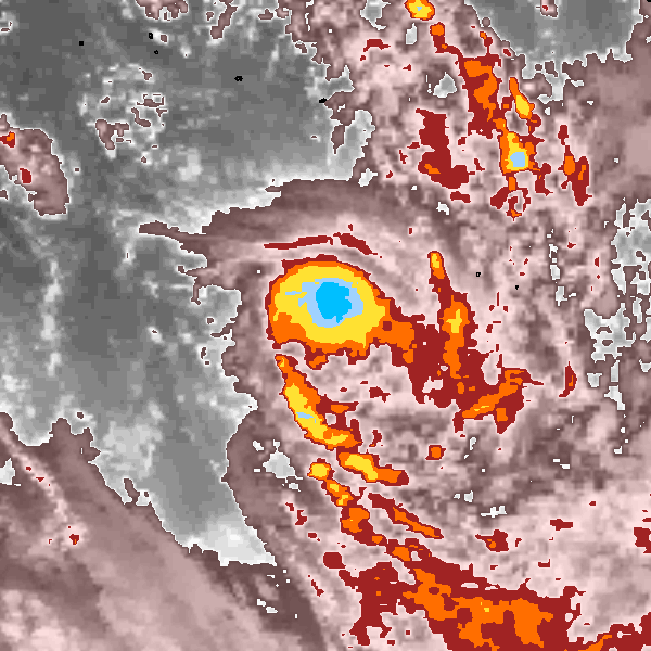
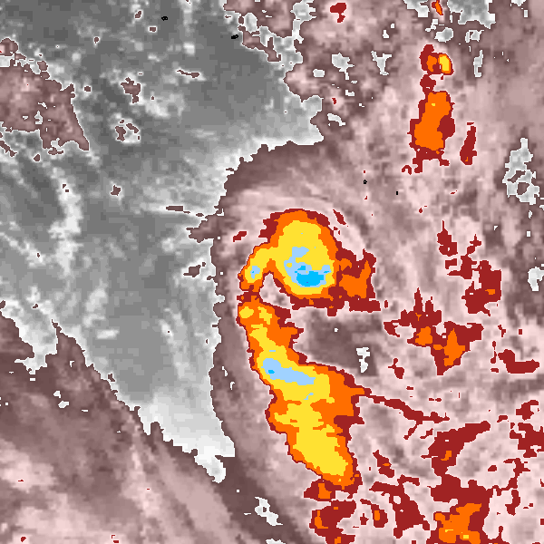
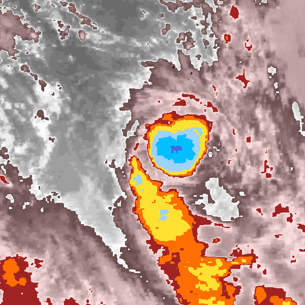
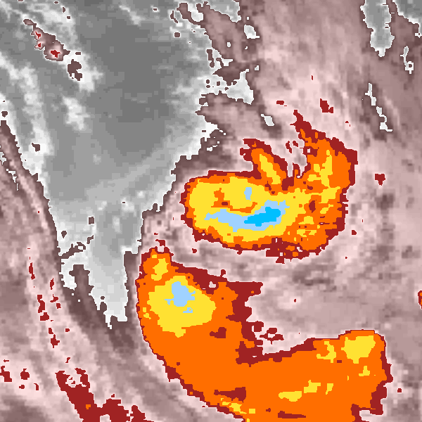
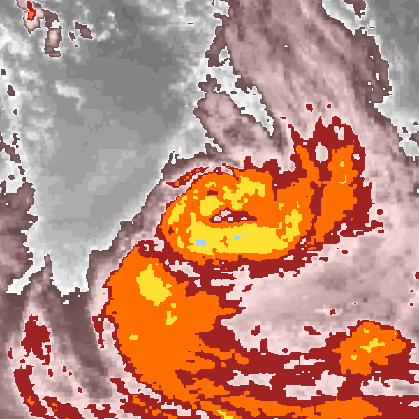
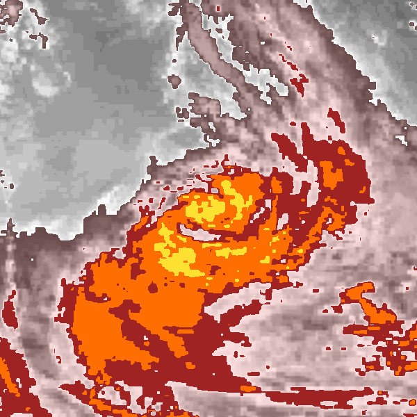
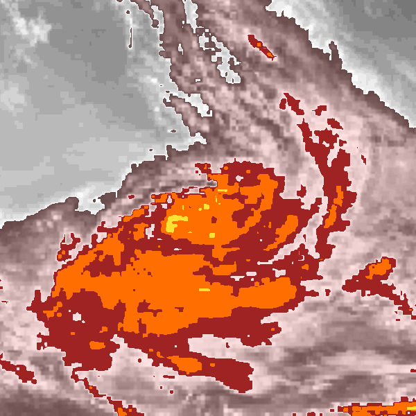
Storm track plot
|
Intensity plots
|
Radial wind information
No radial wind information for this storm
|
Position and Intensity Table
Source Information
| Agency |
Information |
| USA |
bsh081999.txt |
| TOKYO |
|
| CMA |
|
| HKO |
|
| KMA |
|
| NEWDELHI |
|
| REUNION |
|
| BOM |
|
| NADI |
|
| WELLINGTON |
|
| DS824 |
|
| TD9636 |
|
| TD9635 |
|
| NEUMANN |
tracks.sh:Storm=1147:HSK0899:BSH081999:JTWC |
| MLC |
|
All available IBTrACS Data
| SEASON |
BASIN |
SUBBASIN |
ISO_TIME_________ |
NATURE |
LAT |
LON |
DIST2LAND |
LANDFALL |
IFLAG |
USA AGENCY |
USA ATCF_ID |
USA LAT |
USA LON |
USA WIND |
USA SSHS |
NEUMANN LAT |
NEUMANN LON |
NEUMANN CLASS |
NEUMANN WIND |
STORM SPEED |
STORM DIR |
| Year |
|
|
|
|
degrees north |
degrees east |
km |
km |
|
|
|
degrees north |
degrees east |
kts |
1 |
degrees north |
degrees east |
|
kts |
kts |
degrees |
| 1999 |
SP |
MM |
1998-12-21 00:00:00 |
TS |
-20.40 |
-150.10 |
2459 |
2435 |
O____________O_ |
jtwc_sh |
SH081999 |
-20.40 |
-150.10 |
25 |
-1 |
-20.40 |
-150.10 |
TC |
25 |
6 |
235 |
| 1999 |
SP |
MM |
03:00:00 |
TS |
-20.60 |
-150.40 |
2435 |
2417 |
P____________P_ |
|
SH081999 |
-20.60 |
-150.40 |
25 |
-1 |
-20.60 |
-150.40 |
TC |
25 |
6 |
235 |
| 1999 |
SP |
MM |
06:00:00 |
TS |
-20.70 |
-150.60 |
2417 |
2400 |
O____________O_ |
jtwc_sh |
SH081999 |
-20.70 |
-150.60 |
25 |
-1 |
-20.70 |
-150.60 |
TC |
25 |
4 |
240 |
| 1999 |
SP |
MM |
09:00:00 |
TS |
-20.80 |
-150.80 |
2400 |
2390 |
P____________P_ |
|
SH081999 |
-20.80 |
-150.80 |
26 |
-1 |
-20.80 |
-150.80 |
TC |
25 |
3 |
240 |
| 1999 |
SP |
MM |
12:00:00 |
TS |
-20.90 |
-150.90 |
2393 |
2373 |
P____________O_ |
|
SH081999 |
-20.80 |
-151.00 |
28 |
-1 |
-20.90 |
-150.90 |
TC |
25 |
4 |
240 |
| 1999 |
SP |
MM |
15:00:00 |
TS |
-21.00 |
-151.10 |
2376 |
2363 |
P____________P_ |
|
SH081999 |
-21.00 |
-151.10 |
29 |
-1 |
-21.00 |
-151.10 |
TC |
28 |
5 |
225 |
| 1999 |
SP |
MM |
18:00:00 |
TS |
-21.20 |
-151.30 |
2363 |
2343 |
O____________O_ |
jtwc_sh |
SH081999 |
-21.20 |
-151.30 |
30 |
-1 |
-21.20 |
-151.30 |
TC |
30 |
8 |
215 |
| 1999 |
SP |
MM |
21:00:00 |
TS |
-21.60 |
-151.60 |
2347 |
2338 |
P____________P_ |
|
SH081999 |
-21.60 |
-151.60 |
33 |
-1 |
-21.60 |
-151.60 |
TC |
33 |
10 |
205 |
| 1999 |
SP |
MM |
1998-12-22 00:00:00 |
TS |
-22.10 |
-151.80 |
2346 |
2346 |
O____________O_ |
jtwc_sh |
SH081999 |
-22.10 |
-151.80 |
35 |
0 |
-22.10 |
-151.80 |
TC |
35 |
11 |
190 |
| 1999 |
SP |
MM |
03:00:00 |
TS |
-22.70 |
-151.80 |
2369 |
2369 |
P____________P_ |
|
SH081999 |
-22.70 |
-151.80 |
35 |
0 |
-22.70 |
-151.80 |
TC |
35 |
12 |
170 |
| 1999 |
SP |
MM |
06:00:00 |
TS |
-23.30 |
-151.60 |
2413 |
2413 |
O____________O_ |
jtwc_sh |
SH081999 |
-23.30 |
-151.60 |
35 |
0 |
-23.30 |
-151.60 |
TC |
35 |
13 |
165 |
| 1999 |
SP |
MM |
09:00:00 |
TS |
-23.90 |
-151.40 |
2458 |
2458 |
P____________P_ |
|
SH081999 |
-23.90 |
-151.40 |
35 |
0 |
-23.90 |
-151.40 |
TC |
35 |
14 |
155 |
| 1999 |
SP |
MM |
12:00:00 |
TS |
-24.60 |
-151.00 |
2527 |
2527 |
O____________O_ |
jtwc_sh |
SH081999 |
-24.60 |
-151.00 |
35 |
0 |
-24.60 |
-151.00 |
TC |
35 |
14 |
150 |
| 1999 |
SP |
MM |
15:00:00 |
TS |
-25.20 |
-150.60 |
2592 |
2592 |
P____________P_ |
|
SH081999 |
-25.20 |
-150.60 |
38 |
0 |
-25.20 |
-150.60 |
TC |
38 |
15 |
145 |
| 1999 |
SP |
MM |
18:00:00 |
TS |
-25.80 |
-150.10 |
2666 |
2666 |
O____________O_ |
jtwc_sh |
SH081999 |
-25.80 |
-150.10 |
40 |
0 |
-25.80 |
-150.10 |
TC |
40 |
20 |
140 |
| 1999 |
SP |
MM |
21:00:00 |
TS |
-26.70 |
-149.30 |
2782 |
2782 |
P____________P_ |
|
SH081999 |
-26.70 |
-149.30 |
43 |
0 |
-26.70 |
-149.30 |
TC |
43 |
25 |
140 |
| 1999 |
SP |
MM |
1998-12-23 00:00:00 |
TS |
-27.70 |
-148.30 |
2921 |
2921 |
O____________O_ |
jtwc_sh |
SH081999 |
-27.70 |
-148.30 |
45 |
0 |
-27.70 |
-148.30 |
TC |
45 |
25 |
145 |
| 1999 |
SP |
MM |
03:00:00 |
TS |
-28.70 |
-147.60 |
3033 |
3033 |
P____________P_ |
|
SH081999 |
-28.70 |
-147.60 |
45 |
0 |
-28.70 |
-147.60 |
TC |
45 |
26 |
145 |
| 1999 |
SP |
MM |
06:00:00 |
TS |
-29.90 |
-146.70 |
3174 |
3174 |
O____________O_ |
jtwc_sh |
SH081999 |
-29.90 |
-146.70 |
45 |
0 |
-29.90 |
-146.70 |
TC |
45 |
35 |
145 |
| 1999 |
SP |
MM |
09:00:00 |
TS |
-31.50 |
-145.30 |
3347 |
3347 |
P____________P_ |
|
SH081999 |
-31.50 |
-145.30 |
48 |
0 |
-31.50 |
-145.30 |
TC |
48 |
44 |
140 |
| 1999 |
SP |
MM |
12:00:00 |
TS |
-33.30 |
-143.50 |
3434 |
3434 |
O____________O_ |
jtwc_sh |
SH081999 |
-33.30 |
-143.50 |
50 |
0 |
-33.30 |
-143.50 |
TC |
50 |
46 |
140 |
| 1999 |
SP |
MM |
15:00:00 |
TS |
-35.10 |
-141.80 |
3520 |
3520 |
P____________P_ |
|
SH081999 |
-35.10 |
-141.80 |
43 |
0 |
-35.10 |
-141.80 |
TC |
43 |
47 |
140 |
| 1999 |
SP |
MM |
18:00:00 |
TS |
-36.80 |
-139.70 |
3651 |
3651 |
O____________O_ |
jtwc_sh |
SH081999 |
-36.80 |
-139.70 |
35 |
0 |
-36.80 |
-139.70 |
TC |
35 |
51 |
130 |
| 1999 |
SP |
MM |
21:00:00 |
TS |
-38.40 |
-137.10 |
3830 |
3739 |
P____________P_ |
|
SH081999 |
-38.40 |
-137.10 |
33 |
-1 |
-38.40 |
-137.10 |
TC |
33 |
54 |
125 |
| 1999 |
SP |
MM |
1998-12-24 00:00:00 |
TS |
-39.90 |
-134.00 |
3727 |
|
O____________O_ |
jtwc_sh |
SH081999 |
-39.90 |
-134.00 |
30 |
-1 |
-39.90 |
-134.00 |
TC |
30 |
56 |
120 |