

RECENT POSTS
NCICS's Dr. Madhusmita Swain is lead author on a new paper in the journal Atmosphere (open access).

www.mdpi.com
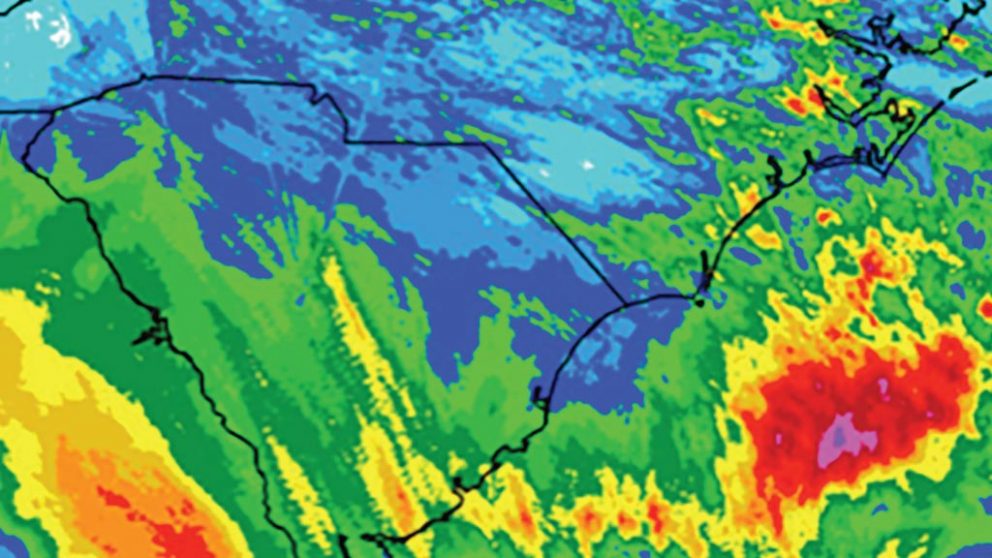
Precipitation is among the most uncertain and poorly predicted weather products in earth system science. Local convective precipitation is particularly sensitive to strong land–atmosphere coupling. ...0 CommentsComment on Facebook
NCICS’s Dr. Carl Schreck is quoted extensively in this in-depth report from the American Society of Civil Engineers.
“We are really confident that storms are getting wetter,” Schreck said. “Any rainstorm today is going to drop more rain than it would have 100 years ago.”

Wetter storms drive need for resilient infrastructure as hurricane season opens
www.asce.org
Civil engineers face six months of uncertainty as wetter hurricanes increase flood risk. See how stormwater managers are adapting aging infrastructure.0 CommentsComment on Facebook