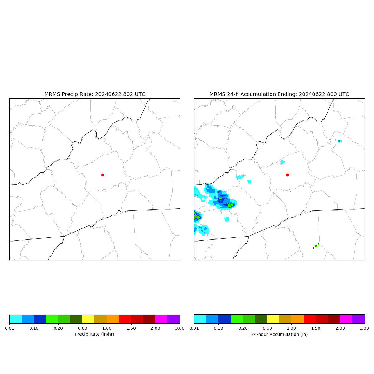
| Time | Temp | Pressure | Wind | Dew Point | Humidity |
|---|---|---|---|---|---|
| Time | Temp | Pressure | Wind | Dew Point | Humidity |
|---|---|---|---|---|---|
Asheville Forecast
Wed 24, 2026 3:33 AM EDT
Mostly sunny. Highs around 80. Northwest winds around 5 mph.
Partly cloudy. Lows in the upper 50s. Southeast winds around 5 mph in the evening, becoming light and variable.
Mostly sunny. Highs in the mid 80s. Southwest winds around 5 mph.
Partly cloudy. Lows in the lower 60s. South winds around 5 mph.
Sunny in the morning, then partly sunny with showers likely with a chance of thunderstorms in the afternoon. Highs in the mid 80s. Southwest winds around 5 mph. Chance of rain 70 percent.
Partly cloudy. A chance of showers and thunderstorms in the evening. Lows in the mid 60s. Chance of rain 50 percent.
Mostly sunny. A chance of showers and thunderstorms in the afternoon. Highs in the upper 80s. Chance of rain 40 percent.
Partly cloudy. A chance of showers and thunderstorms in the evening. Lows in the mid 60s. Chance of rain 40 percent.
Mostly sunny in the morning, then becoming partly sunny. A chance of showers and thunderstorms. Highs in the mid 80s. Chance of rain 40 percent.
Partly cloudy. A chance of showers and thunderstorms in the evening. Lows in the mid 60s. Chance of rain 40 percent.
Mostly sunny in the morning, then partly sunny with a chance of showers and thunderstorms in the afternoon. Highs in the mid 80s. Chance of rain 50 percent.
Partly cloudy. A chance of showers and thunderstorms in the evening. Lows in the mid 60s. Chance of rain 50 percent.
Mostly sunny. A chance of showers and thunderstorms in the afternoon. Highs in the upper 80s. Chance of rain 40 percent.
GOES Imagery
GOES East
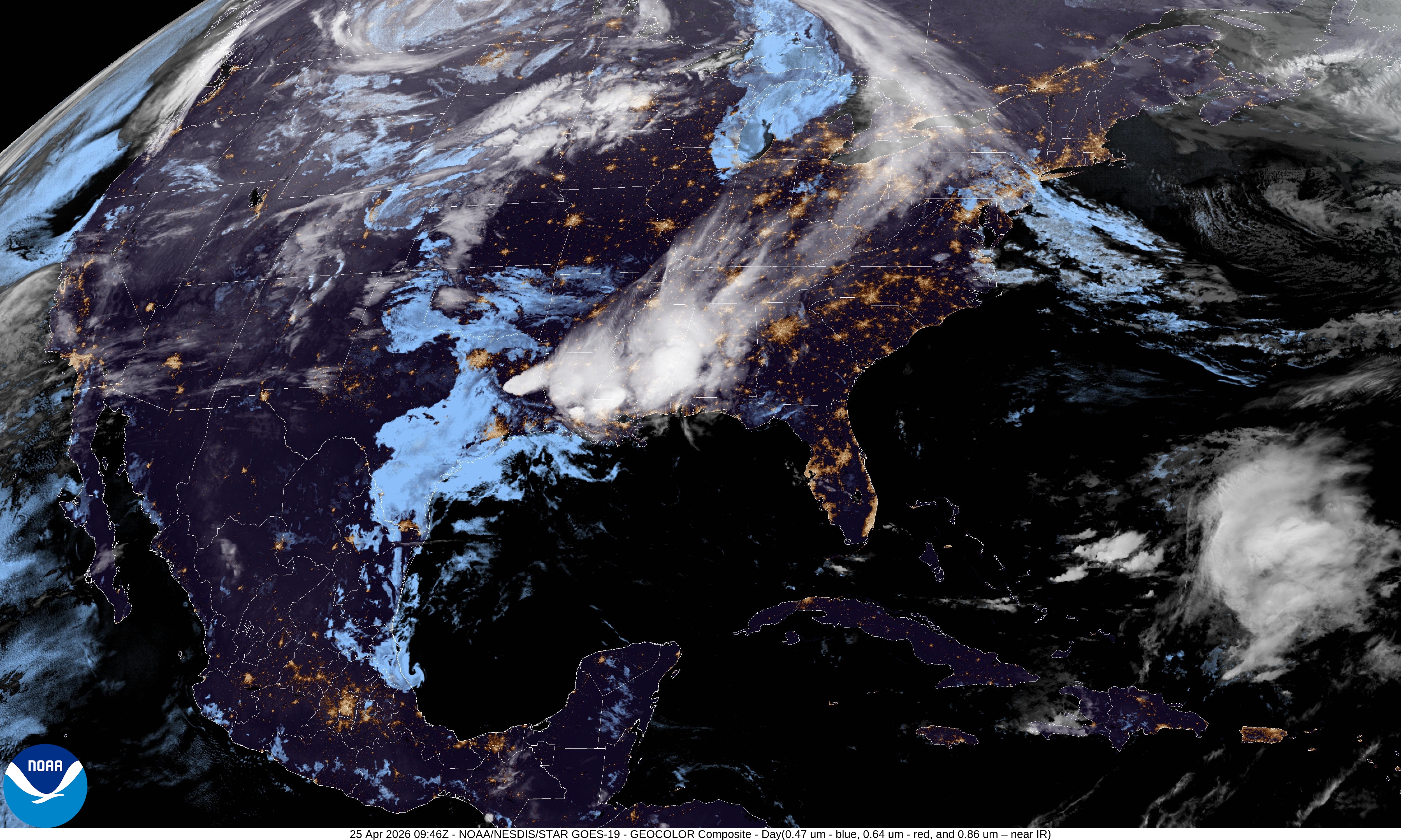
GeoColor
GOES West
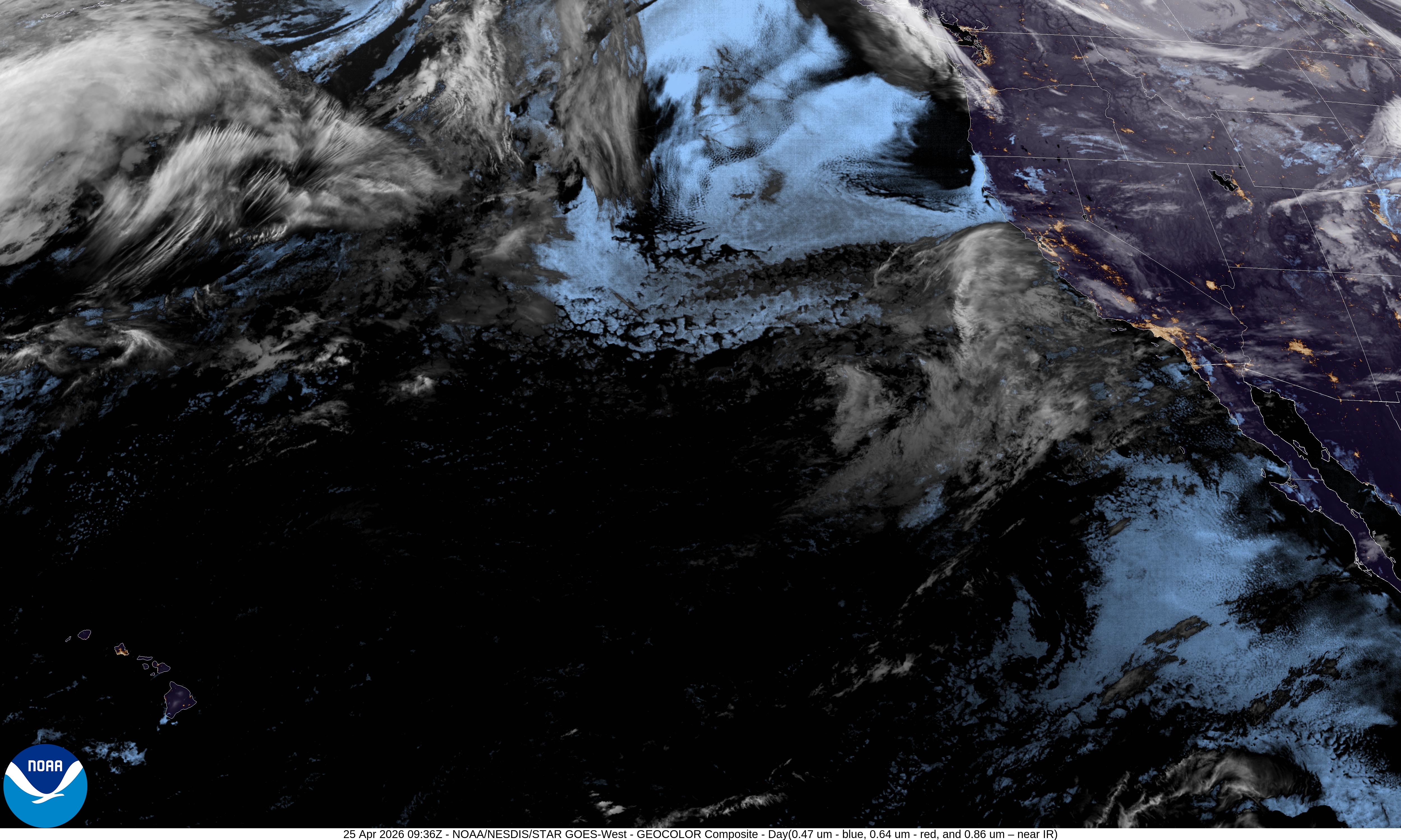
GeoColor
