| Time | Temp | Pressure | Wind | Dew Point | Humidity |
|---|---|---|---|---|---|
| Time | Temp | Pressure | Wind | Dew Point | Humidity |
|---|---|---|---|---|---|
Asheville Forecast
Wed 22, 2026 3:34 AM EDT
A chance of thunderstorms with a slight chance of showers this morning, then showers with thunderstorms likely this afternoon. Highs in the lower 80s. Southwest winds 5 to 10 mph. Chance of rain near 100 percent.
Showers with thunderstorms likely in the evening, then showers likely after midnight. Patchy fog after midnight. lows in the mid 60s. Northwest winds around 5 mph. Chance of rain 90 percent.
Patchy fog in the morning. Showers in the morning, then showers with thunderstorms likely in the afternoon. Humid with highs in the mid 70s. East winds around 5 mph. Chance of rain 90 percent.
Showers with a chance of thunderstorms in the evening, then showers likely after midnight. Lows in the lower 60s. Southeast winds 5 to 10 mph. Chance of rain 90 percent.
Mostly cloudy. A chance of showers in the morning, then showers likely with a chance of thunderstorms in the afternoon. Highs in the mid 70s. Southeast winds around 5 mph. Chance of rain 70 percent.
A chance of thunderstorms in the evening. Showers likely. Lows in the mid 60s. Chance of rain 70 percent.
Showers likely in the morning, then showers with thunderstorms likely in the afternoon. Highs in the upper 70s. Chance of rain 90 percent.
Mostly cloudy with showers with thunderstorms likely in the evening, then partly cloudy with a chance of showers and thunderstorms after midnight. Lows in the mid 60s. Chance of rain 80 percent.
Mostly sunny. Highs in the lower 80s.
Mostly clear. Lows in the mid 60s.
Mostly sunny. Highs in the mid 80s.
Partly cloudy. A chance of showers after midnight. Lows in the mid 60s. Chance of rain 40 percent.
Mostly sunny in the morning, then becoming partly sunny. A chance of showers. A chance of thunderstorms in the afternoon. Highs in the mid 80s. Chance of rain 50 percent.
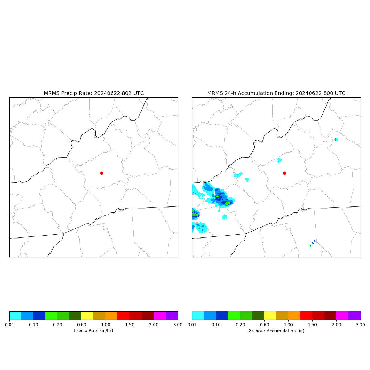
GOES Imagery
GOES East
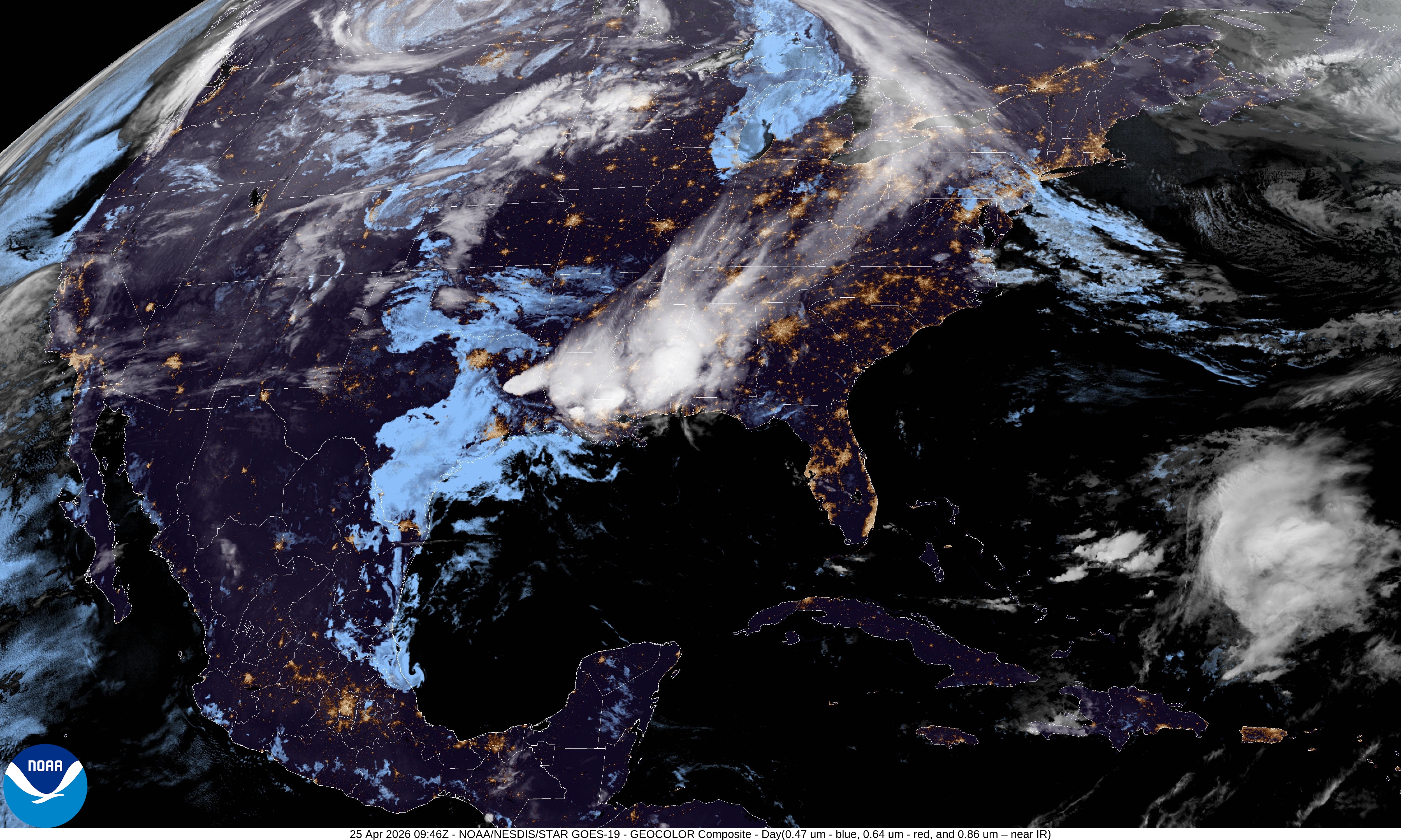
GeoColor
GOES West
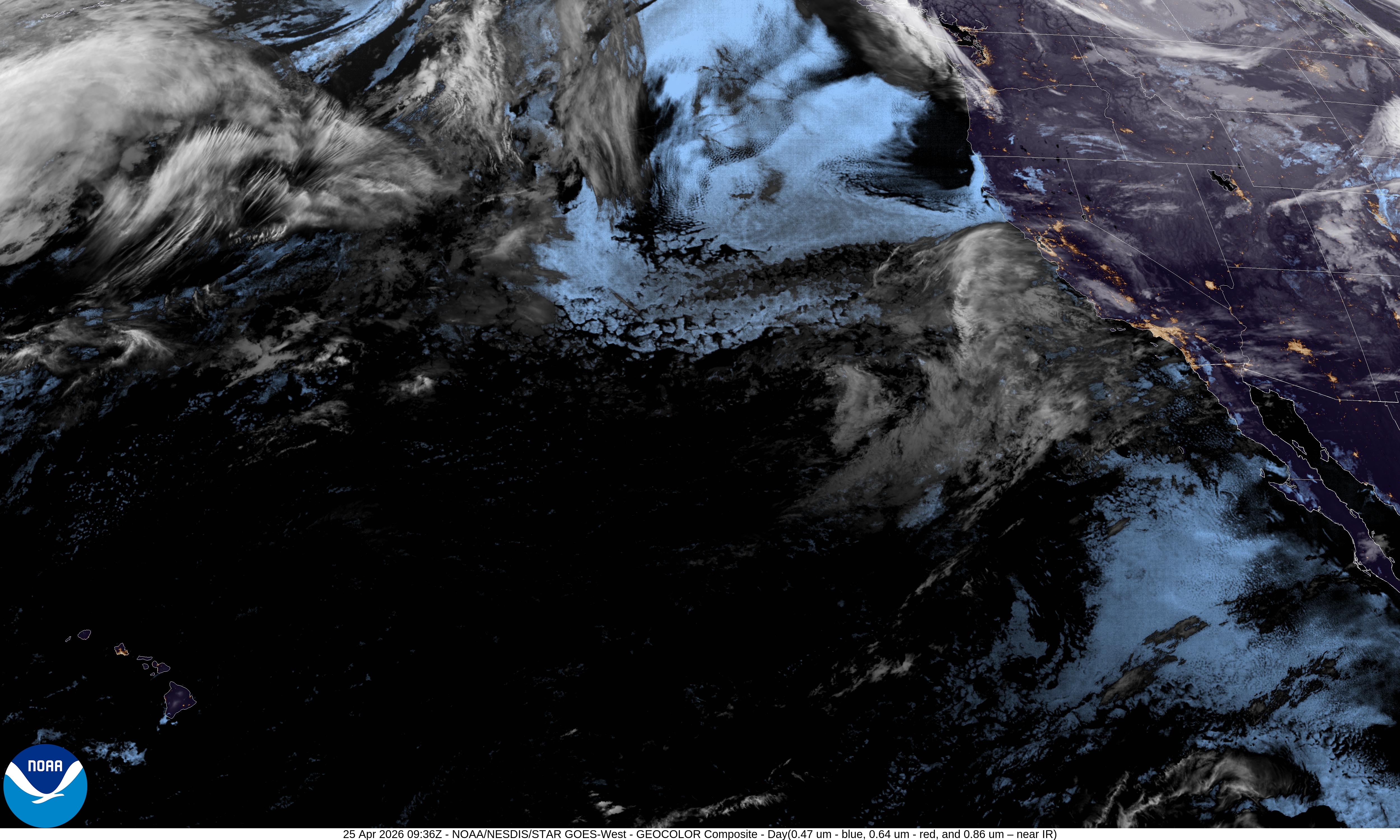
GeoColor
