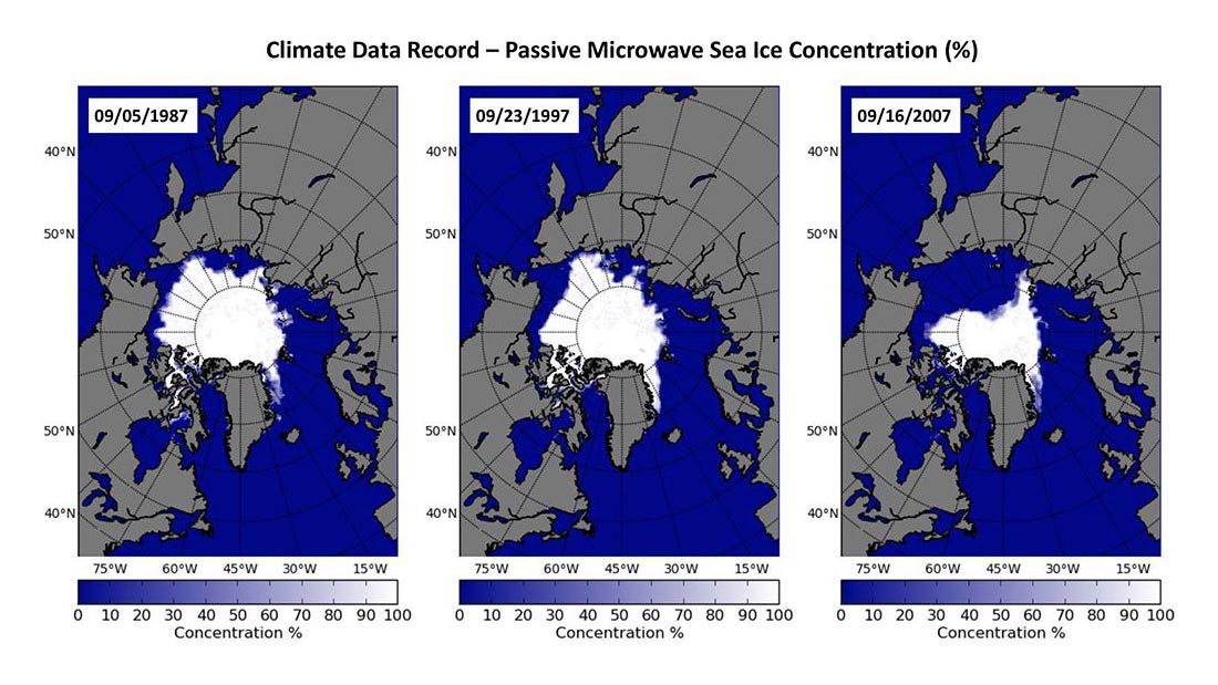
Spatial distribution of daily sea ice concentrations on the minimum sea ice extent day in year 1987, 1997, and 2007 shows clearly the shrinking of Arctic sea ice coverage, which is occurring faster than most of the climate model predictions.
With the substantial change in the Arctic sea ice and associated impacts of the change in weather and climate system, ecosystems, and coastal communities, it is valuable to have a climate data record (CDR) quality sea ice concentration product for climate studies, monitoring, and model validation.
A satellite-based passive microwave sea ice concentration product has been transitioned from research to operation (R2O) through collaboration between the National Oceanic and Atmospheric Administration (NOAA)’s National Centers for Environmental Information (NCEI) CDR Program and the National Snow and Ice Data Center (NSIDC). This product leverages two well-established and well-validated concentration algorithms developed at the National Aeronautics and Space Administration (NASA) Goddard Space Flight Center (GSFC), but with enhanced documentation and metadata for transparency and traceability. Fig. 1 displays areal sea ice extents for September 1987, 1997, and 2007 — September is the climatological minimum for ice concentration. The diminishing Arctic ice coverage over this 20-year period is apparent. In September 2012, a record low Arctic sea ice extent minimum was reached, well below the previous Arctic sea ice extent minimum record set in September 2007.
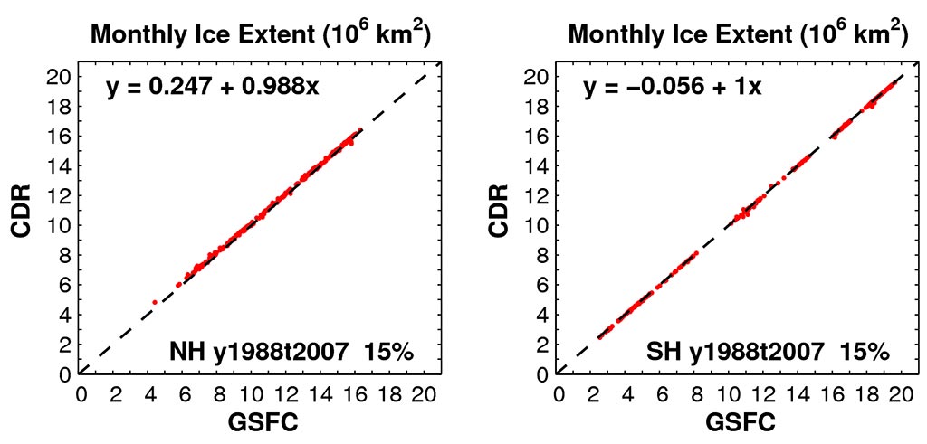
Scatter-diagram of sea ice extents (106 km2) from 20 years monthly CDR and GSFC concentrations (January 1988 – December 2007) shows no systematic bias between the two fields. Left panel is for the Northern Hemisphere and the right panel is for Southern Hemisphere.
As the scientific steward, Dr. Ge Peng (CICS-NC) has been actively working with the data provider (Dr. Meier, NSIDC) in evaluating and verifying the CDR with other satellite-based sea ice products. The product has shown to capture well the seasonal, inter-annual, and decadal variability. Fig. 2 compares monthly sea ice extent from this product, which is machine generated and reproducible, with the NASA/GSFC product-based sea ice extent, which has a significant human intervention and therefore, is not reproducible. There is good agreement between them in both hemispheres.
The next steps for this project are to finalize characterization of this sea ice CDR and to provide additional statistical characteristics of the CDR variables including trends, spatial and temporal variability to users.
Peng, G., W.N. Meier, D.J. Scott, and M. Savoie, A long-term and reproducible satellite-based passive microwave sea ice concentration data record for climate study and monitoring. Earth Syst. Sci. Data, 5, doi:10.5194/essd-5-311-2013