Tag: Satellites
Aug 8, 2017
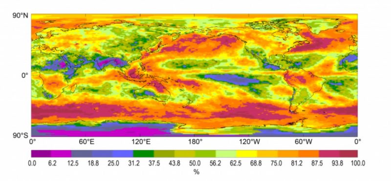
Updated International Satellite Cloud Climatology Project (ISCCP) Data
NOAA’s National Centers for Environmental Information recently announced the release of an updated version of the International Satellite Cloud Climatology Project (ISCCP) dataset. ISCCP uses…

Anand Inamdar
Dr. Anand Inamdar is a Research Scholar with NCICS. Since joining NCICS in 2010, Dr. Inamdar has worked on several projects, including calibration of the…

Otis Brown
Dr. Otis Brown is the founding Director of NCICS, and serves as the Director of the North Carolina location of NOAA’s Cooperative Institute for Satellite…
Feb 3, 2016
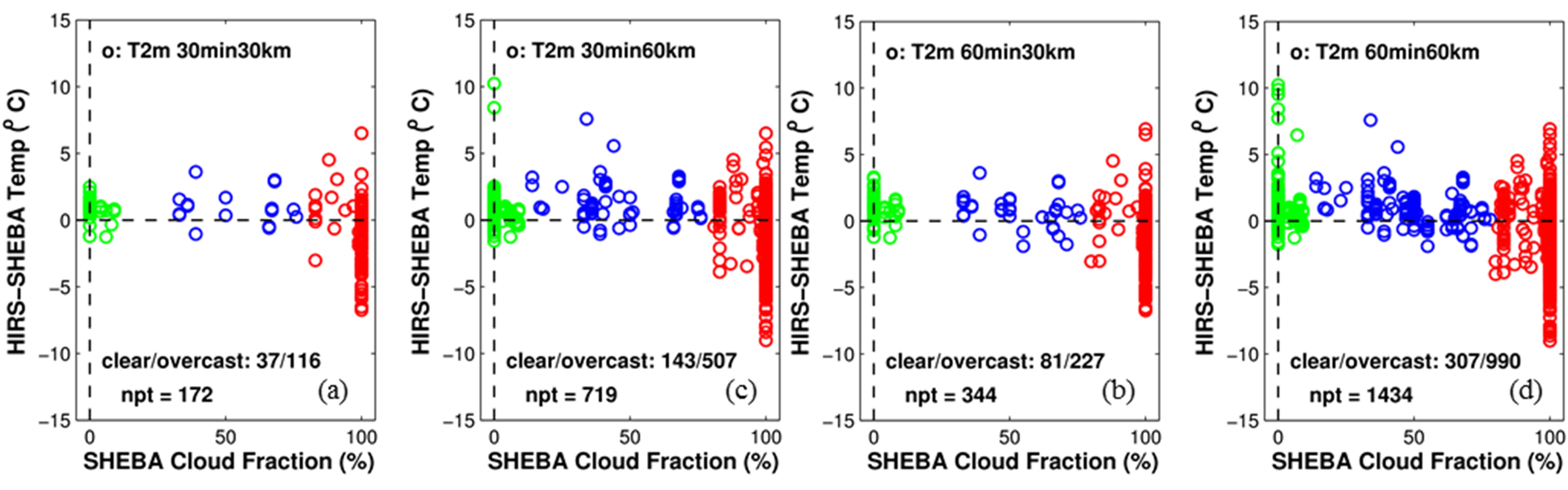
An Evaluation of HIRS Near-Surface Air Temperature Product in the Arctic with SHEBA Data
In an effort to improve our understanding of how the Arctic climate is changing, scientists from CICS-NC and NOAA are working to develop a new…
Oct 1, 2015
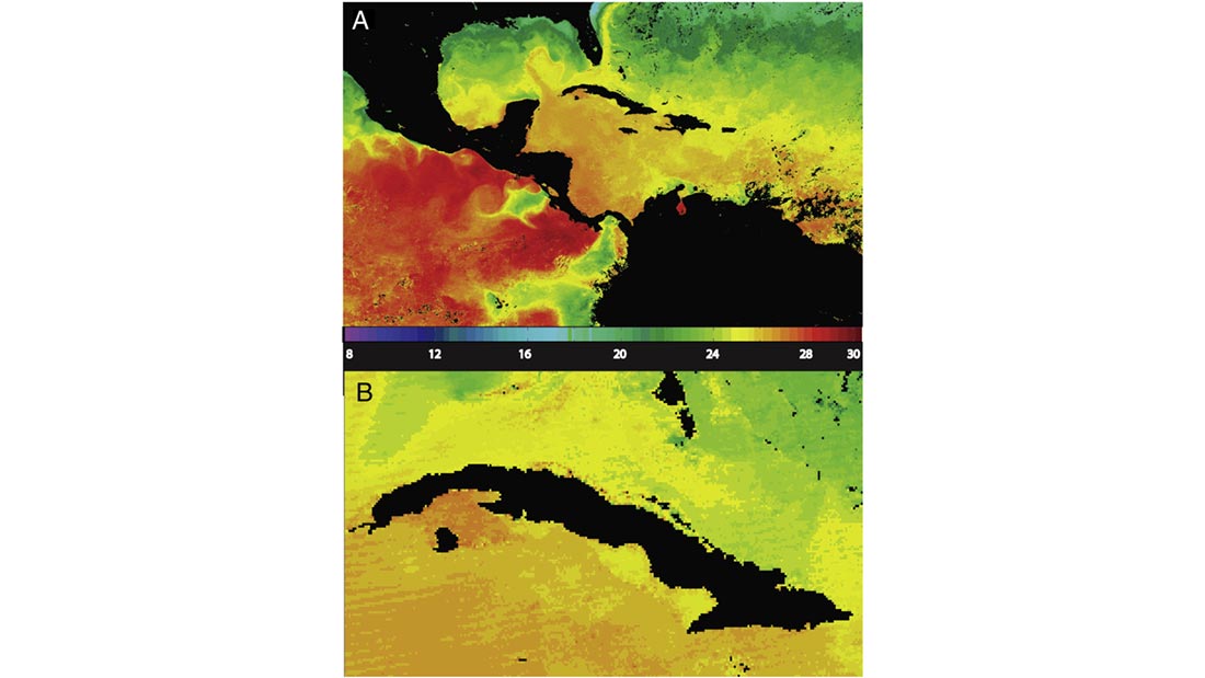
MODIS: A Decade of Sea Surface Temperatures
Satellite-based instruments are the best tools we have for measuring sea surface temperatures (SSTs) on a global scale, but turning infrared sensor data into accurate…
Jul 13, 2015
Calibrating Satellite Data to Better Understand Clouds
The International Satellite Cloud Climatology Project (ISCCP) collects and analyzes satellite data in order to advance our understanding of clouds—how they are distributed around the…
Feb 27, 2015
PERSIANN: Climate Data Record and Smartphone App
The Center for Hydrometeorology and Remote Sensing (CHRS) at the University of California, Irvine, a partner of CICS-NC, has developed a smartphone/tablet application called “RainMapper”…
Oct 29, 2014
Validation of Land Surface Temperature products derived from the Visible Infrared Imaging Radiometer
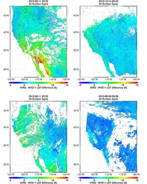
Satellites provide critical weather and climate data, including measurements of surface temperature, but extracting temperature information from raw satellite data requires sophisticated data-processing algorithms. Jim…
Oct 1, 2013
Quantifying Tropical Cyclone Rainfall
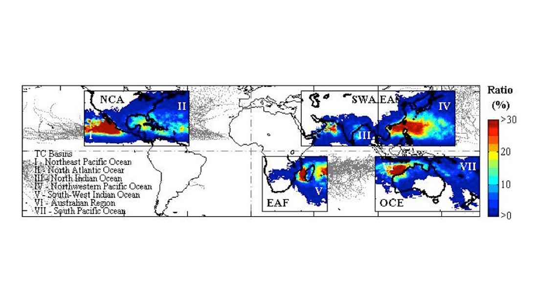
Tropical cyclones (TCs) constitute one of the major natural disasters around the world as well as an important source of fresh water over areas prone…
Apr 19, 2013
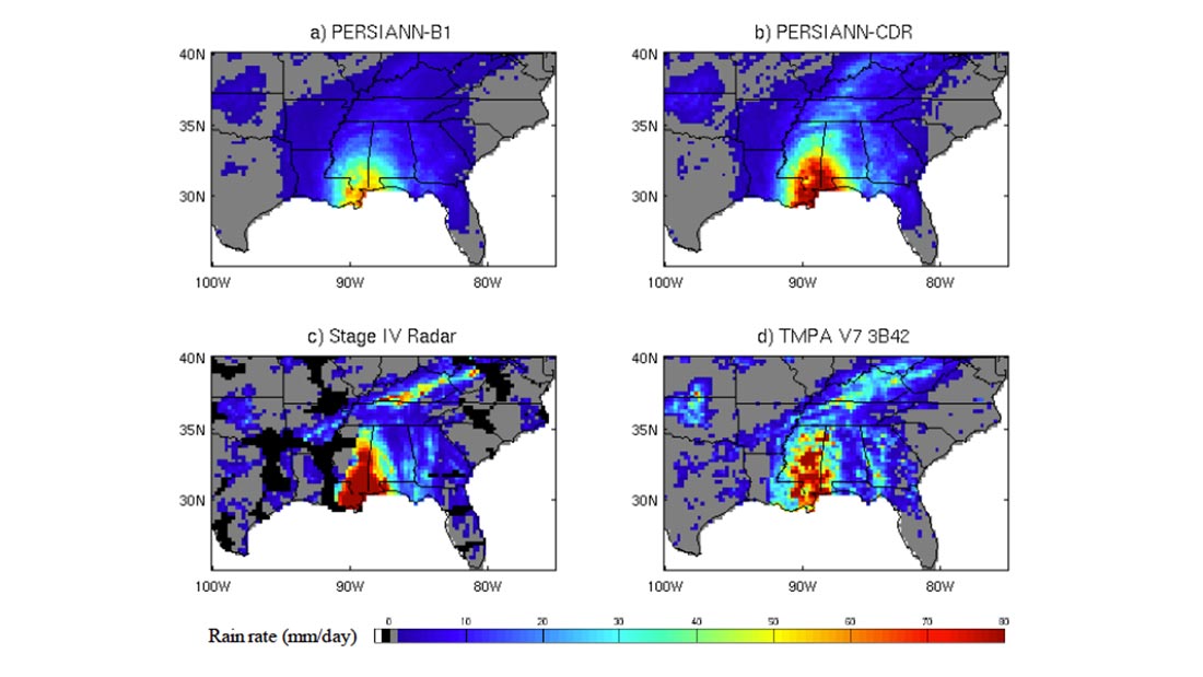
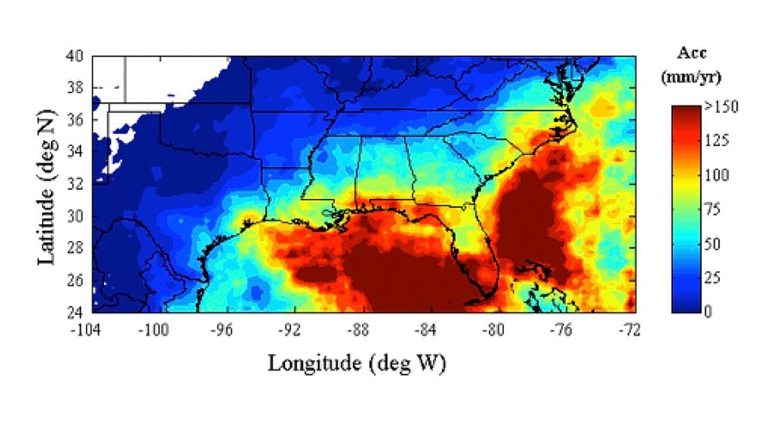
Quantitative Precipitation Estimates for the SE US
The precipitation climatology of the Southeastern United States spans a very broad spectrum of precipitation regimes. A warm season that is characterized by isolated thunderstorms,…