Tag: Remote Sensing
Sep 1, 2016
Obs4MIPS: Connecting Models and Observations
A key part of the validation and assessment of any climate model is to start the model at some time in the past, run it…

Olivier Prat
Since joining NCICS in 2010, Dr. Olivier Prat has worked on quantitative precipitation estimates (QPEs) derived from satellite, radar, and surface observations with a focus…

Anand Inamdar
Dr. Anand Inamdar is a Research Scholar with NCICS. Since joining NCICS in 2010, Dr. Inamdar has worked on several projects, including calibration of the…

Otis Brown
Dr. Otis Brown is the founding Director of NCICS, and serves as the Director of the North Carolina location of NOAA’s Cooperative Institute for Satellite…
Mar 25, 2016
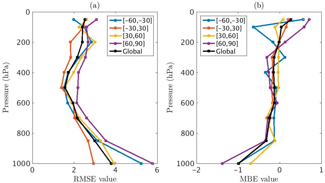
Algorithm Development of Temperature and Humidity Profile Retrievals for Long-Term HIRS Observations
CICS-NC’s Jessica Matthews is a coauthor on a paper in Remote Sensing describing an algorithm for deriving vertical temperature and humidity profiles from the High-resolution…
Mar 22, 2016
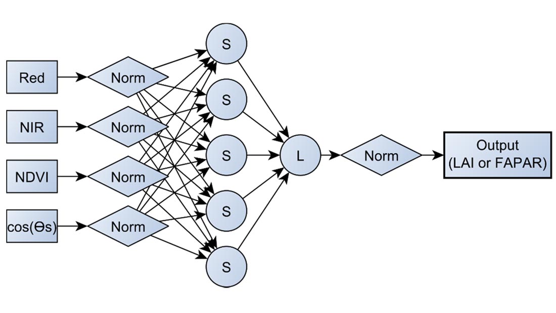
A 30+ Year AVHRR LAI and FAPAR Climate Data Record: Algorithm Description and Validation
CICS-NC’s Jessica Matthews contributed to a paper in Remote Sensing that describes the development of an important new global vegetation data set. This new NOAA…
Oct 1, 2015
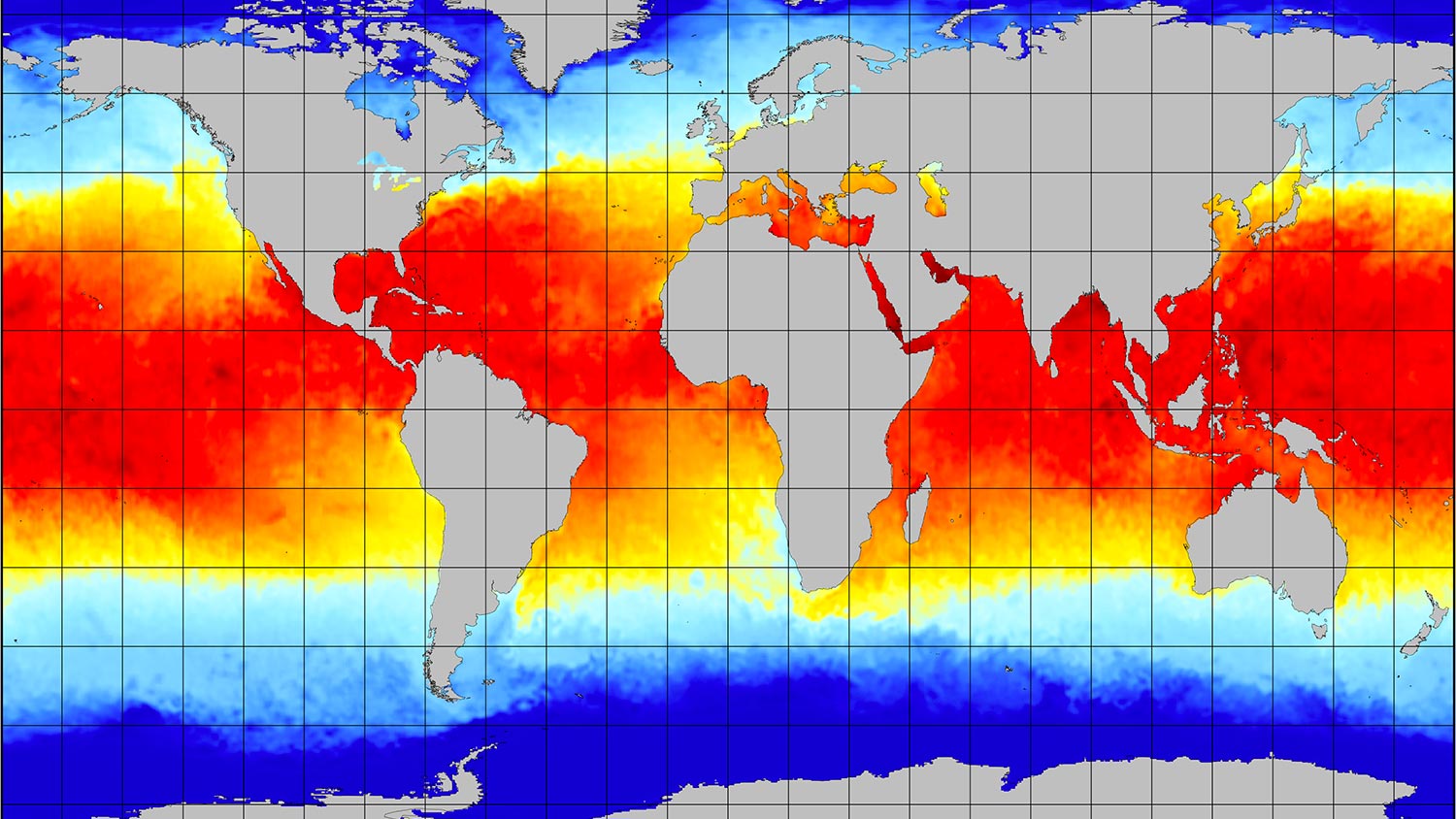
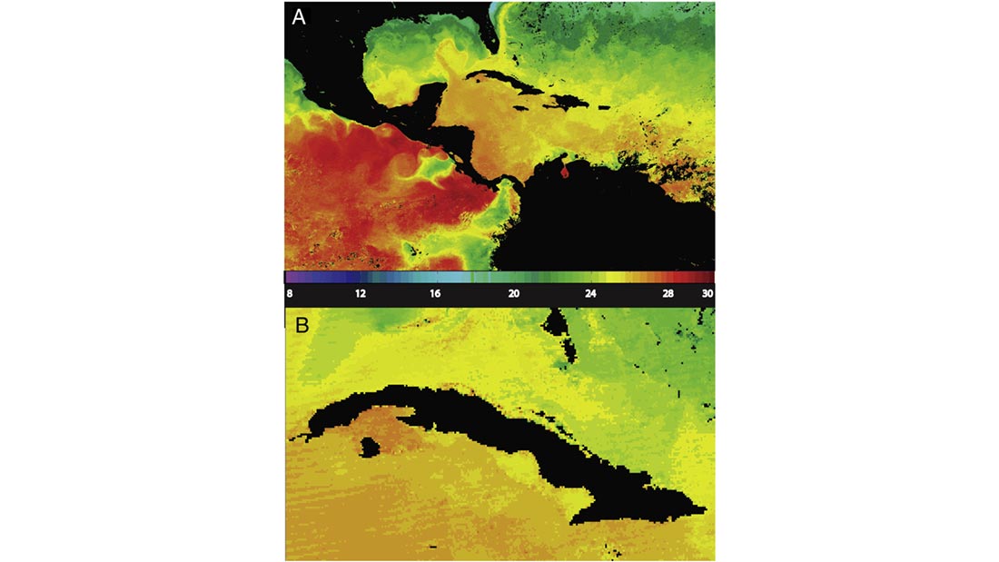
MODIS: A Decade of Sea Surface Temperatures
Satellite-based instruments are the best tools we have for measuring sea surface temperatures (SSTs) on a global scale, but turning infrared sensor data into accurate…
Aug 21, 2015
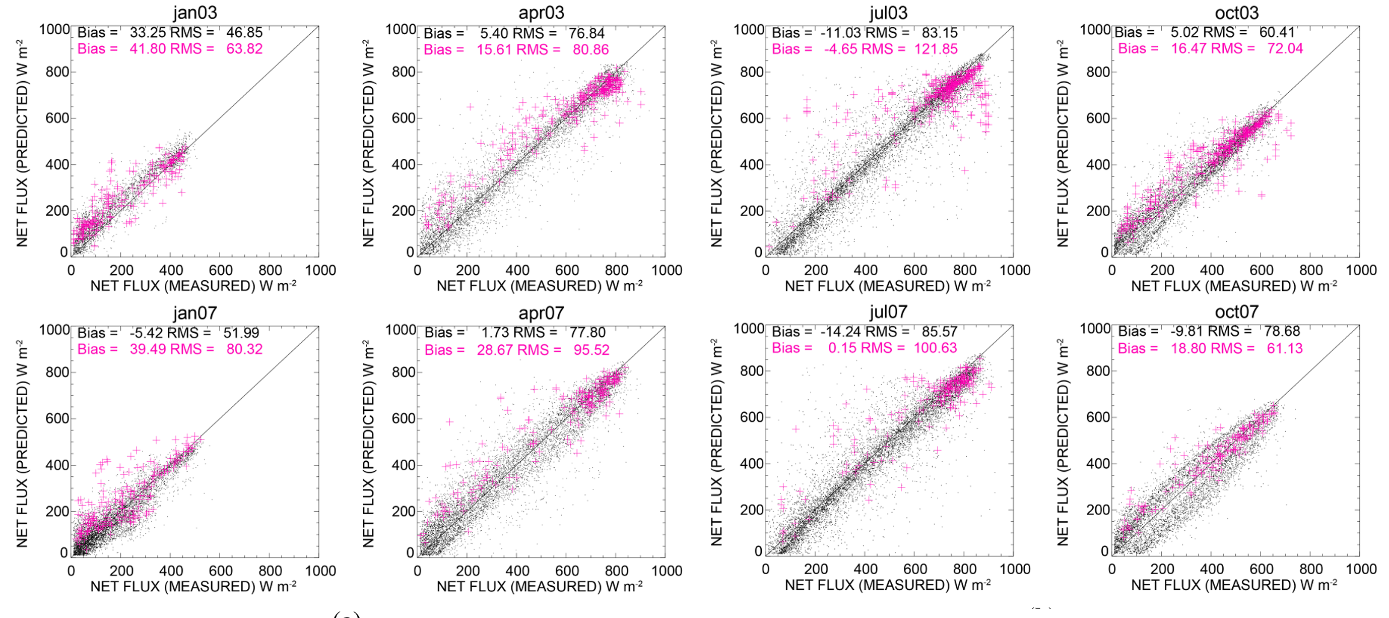
Net Surface Shortwave Radiation from GOES Imagery—Product Evaluation Using Ground-Based Measurements from SURFRAD
The balance of incoming and outgoing radiation at the Earth’s surface plays a crucial role in how energy and water is exchanged between the surface…
Jul 13, 2015
Calibrating Satellite Data to Better Understand Clouds
The International Satellite Cloud Climatology Project (ISCCP) collects and analyzes satellite data in order to advance our understanding of clouds—how they are distributed around the…
Feb 27, 2015
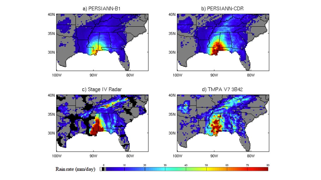
PERSIANN: Climate Data Record and Smartphone App
The Center for Hydrometeorology and Remote Sensing (CHRS) at the University of California, Irvine, a partner of CICS-NC, has developed a smartphone/tablet application called “RainMapper”…