Tag: Remote Sensing
Oct 29, 2014
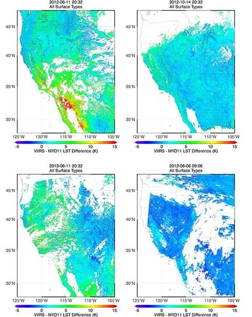
Validation of Land Surface Temperature products derived from the Visible Infrared Imaging Radiometer
Satellites provide critical weather and climate data, including measurements of surface temperature, but extracting temperature information from raw satellite data requires sophisticated data-processing algorithms. Jim…
Oct 1, 2013
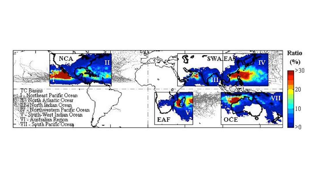
Quantifying Tropical Cyclone Rainfall
Tropical cyclones (TCs) constitute one of the major natural disasters around the world as well as an important source of fresh water over areas prone…
Apr 19, 2013
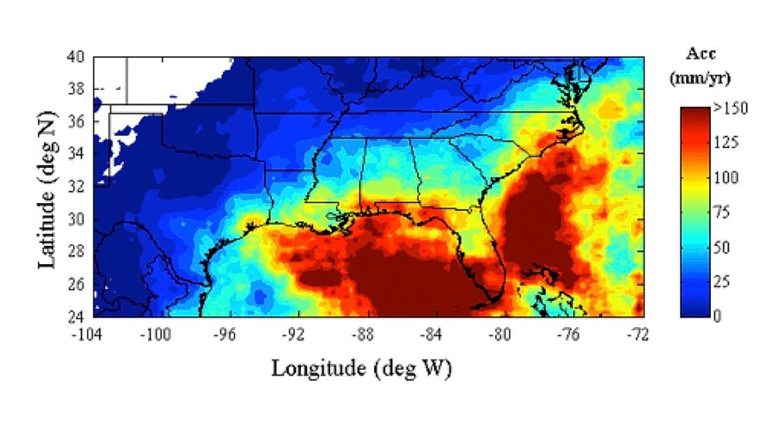
Quantitative Precipitation Estimates for the SE US
The precipitation climatology of the Southeastern United States spans a very broad spectrum of precipitation regimes. A warm season that is characterized by isolated thunderstorms,…
Apr 19, 2013
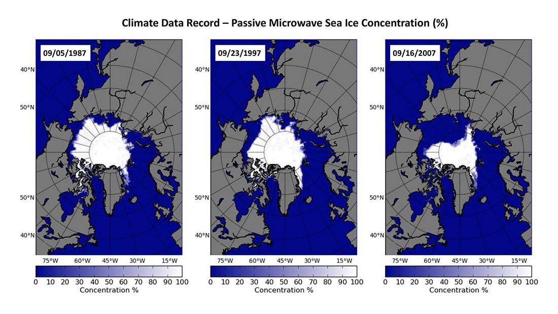
Evaluation and Characterization of Satellite Products
With the substantial change in the Arctic sea ice and associated impacts of the change in weather and climate system, ecosystems, and coastal communities, it…