The U.S. Climate Reference Network (USCRN) is a network of climate monitoring stations maintained and operated by NOAA to provide climate-science-quality measurements of air temperature and precipitation. The purpose of USCRN is to observe the Nation’s changing climate.
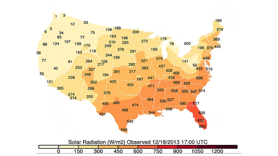
Ronald Leeper, CICS-NC, has developed a web application, CRN-spatial, to visualize near-real time high quality climate observations. This product integrates USCRN data and geographic information system technology to allow users to explore climate data. The purpose of this project is to improve the dissemination of USCRN climate quality data and engage with communities beyond traditional climate scientists, like emergency managers and the general public.
Displaying near-real time USCRN observations graphically provides a new way to facilitate access and inspire innovative research applications that utilize NOAA’s rich datasets.
This map is available on cicsnc.org as an informative tool to reach people beyond the traditional scholarly journals: http://www.cicsnc.org/pub/CRNSpatial/.