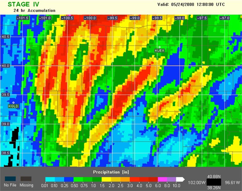
Estimate of 24-hour precipitation from a 2008 thunderstorm using Stage IV, the current state of the art in radar-based rainfall estimation.
The best precipitation dataset in current production in the US provides data every one to three hours, on a scale of roughly 4 km (one pixel for a small town). Using new software developed by NOAA’s National Severe Storms Laboratory, a reanalysis will produce a dataset that provides this information every five minutes at a resolution of 1 km (16 pixels for the same small town).
The images here show the same storm in two ways. The first uses the current state of the art, at 4-km resolution. The second shows the new NMQ/Q2 product, at 1-km resolution. In addition to the greatly increased resolution, the new product can be generated every five minutes, rather than once per hour.
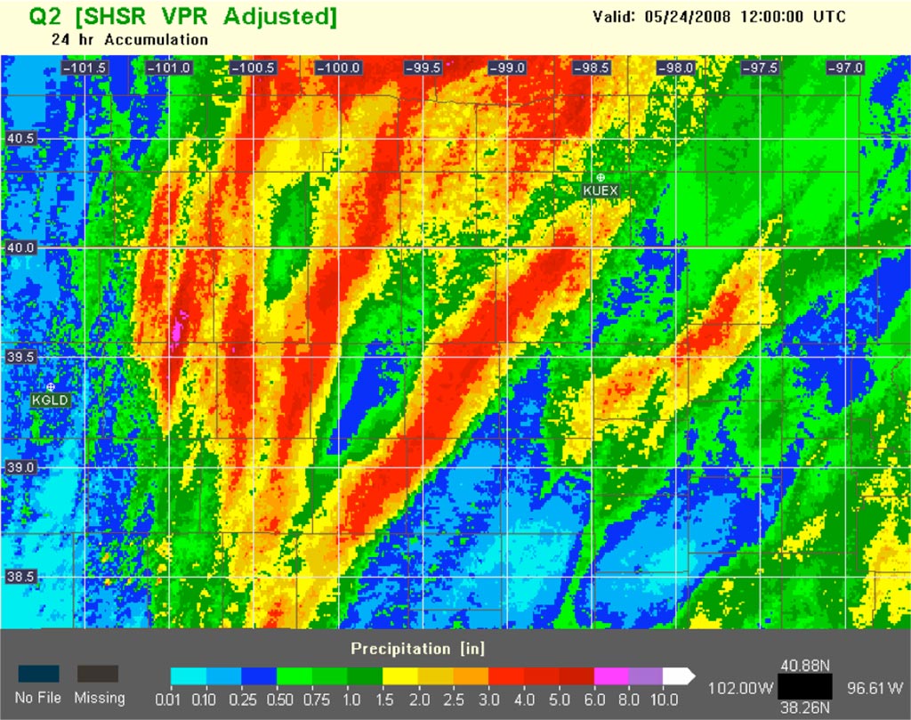
Estimate of same storm using new NMQ/Q2.
This high-resolution dataset will allow for a more precise estimate of rain and snowfall over a given area with much more focused time intervals. Rather than simply knowing how much rain has fallen in a town during the past several hours, it can be determined how much has fallen over a single streambed over any time period that is desired. Such knowledge can prove incredibly valuable to a variety of consumers, who can benefit greatly from such precise information in near-real time. Emergency managers can more accurately gauge an impending flood, researchers can study the fine-scale effects of terrain on rainfall, and insurance companies can get more accurate data on severe weather events that can affect claims.
Using a large computing cluster located at CICS-NC, CICS scientist Scott Stevens is in the process of generating this dataset for the entire United States, over a period from 1998-2011. Once completed in the coming 12-24 months, the process will be adapted to run close to real time. In addition, upgrades to the software will be implemented that take advantage of new radar technology introduced in 2011. These updates will allow for much better estimates of rainfall. The data will be archived and made available to the public and the scientific community.
Visit: http://nmq.ou.edu for more information.