Research Highlights
May 2014
Third National Climate Assessment
The White House released the third National Climate Assessment today. Mandated at least every four years by the Global Change Research Act of 1990, the…
Oct 2013
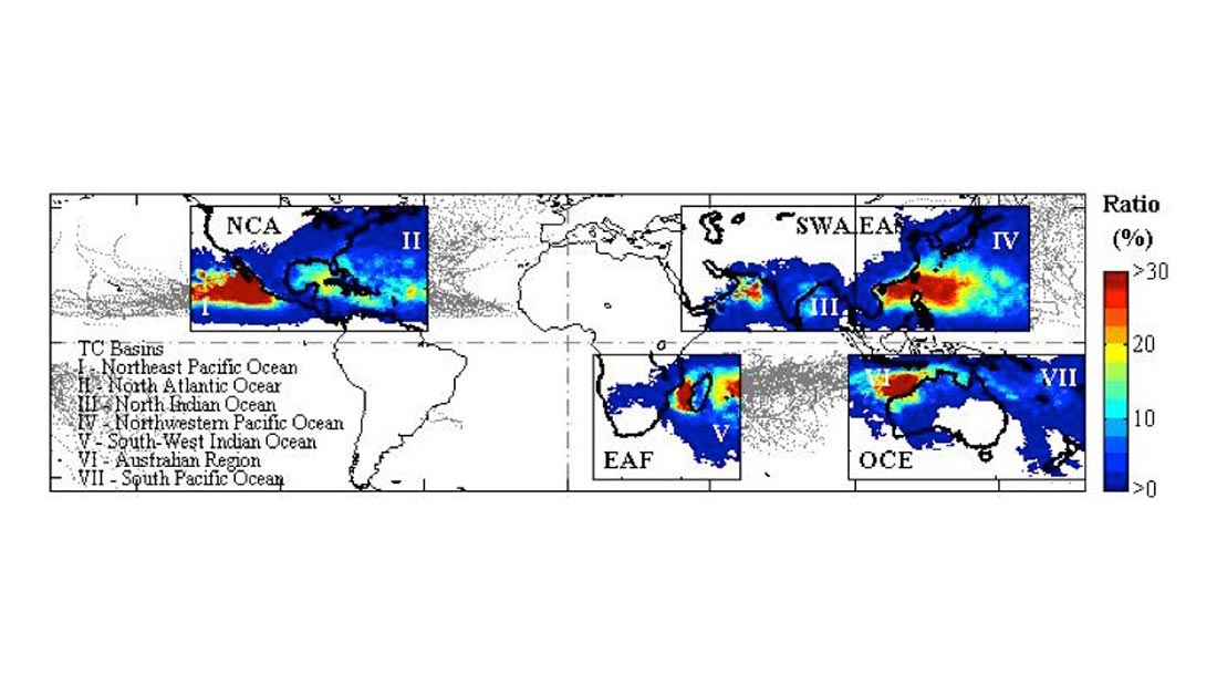
Quantifying Tropical Cyclone Rainfall
Tropical cyclones (TCs) constitute one of the major natural disasters around the world as well as an important source of fresh water over areas prone…
Apr 2013
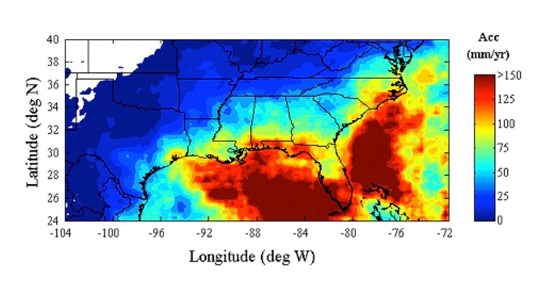
Quantitative Precipitation Estimates for the SE US
The precipitation climatology of the Southeastern United States spans a very broad spectrum of precipitation regimes. A warm season that is characterized by isolated thunderstorms,…
Apr 2013
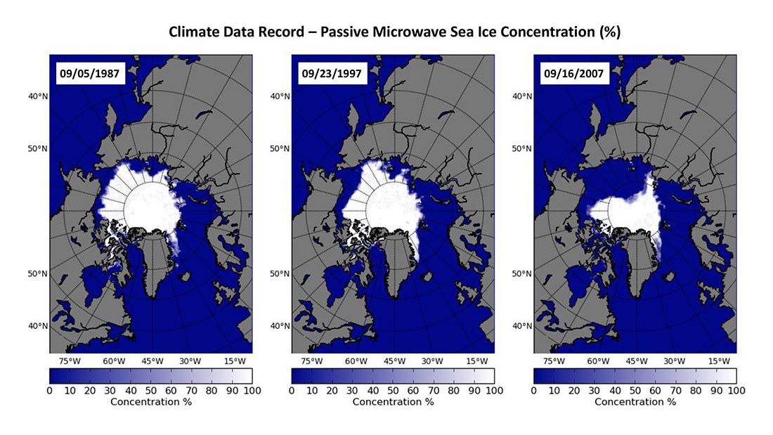
Evaluation and Characterization of Satellite Products
With the substantial change in the Arctic sea ice and associated impacts of the change in weather and climate system, ecosystems, and coastal communities, it…
Apr 2013
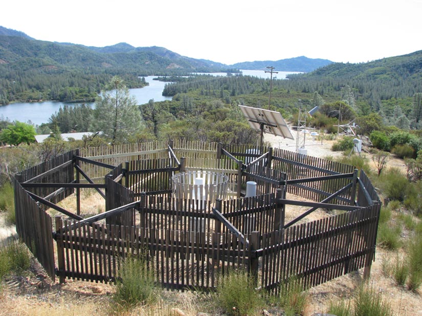
USCRN Precipitation Observations
The U.S. Climate Reference Network (USCRN) is a network of climate-monitoring stations maintained and operated by the National Oceanic and Atmospheric Administration (NOAA) to provide…
Apr 2013
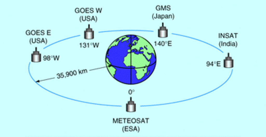
Calibration and Validation of Geostationary Satellite Visible Imagery
Meteorological satellites operating in geostationary orbits around the Earth (Fig. 1) provide us with observations of the Earth’s surface and clouds since the early 1970’s.…
Apr 2013
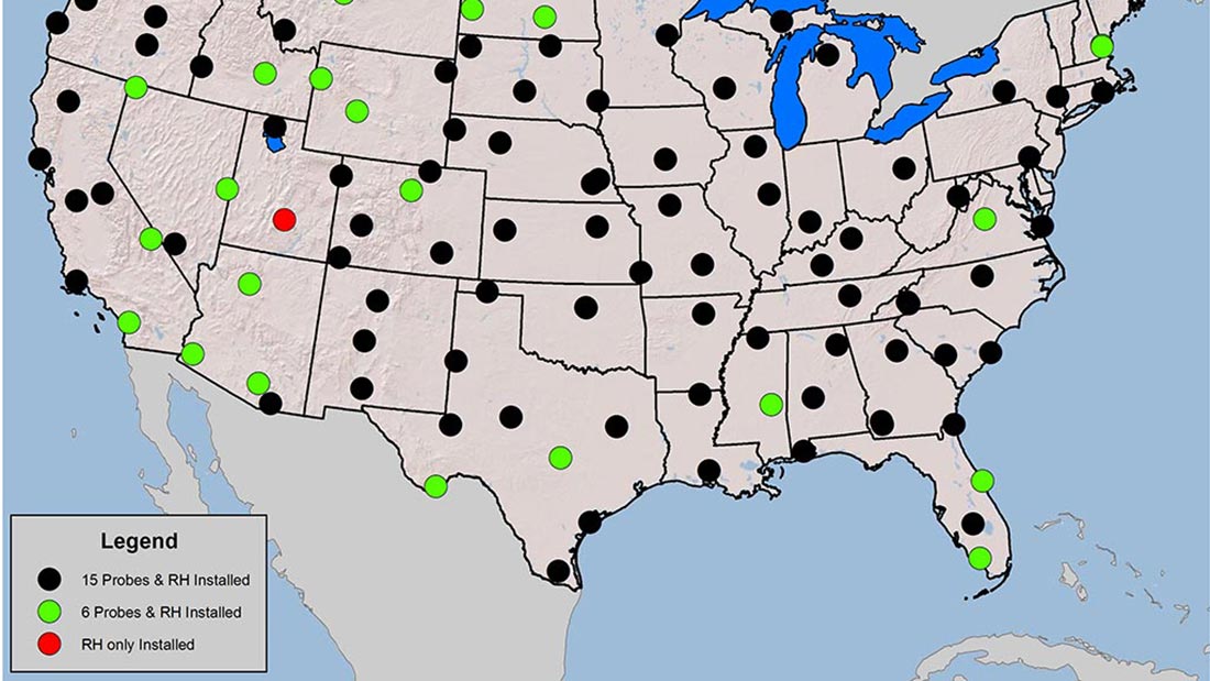
Soil Climate Observations
The U.S. Climate Reference Network (USCRN) is a network of climate-monitoring stations maintained and operated by the National Oceanic and Atmospheric Administration (NOAA) to provide…
Feb 2013
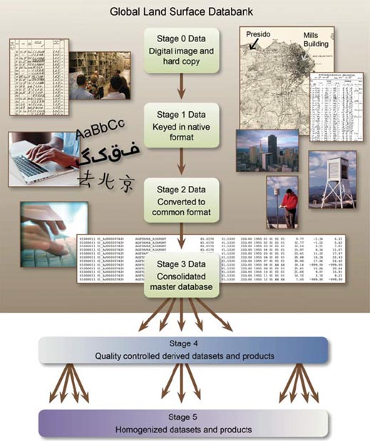
Global Land Surface Temperature
Society expects openness and transparency in climate science to have a greater understanding of the certainty regarding how climate has changed and how it will…
Feb 2013
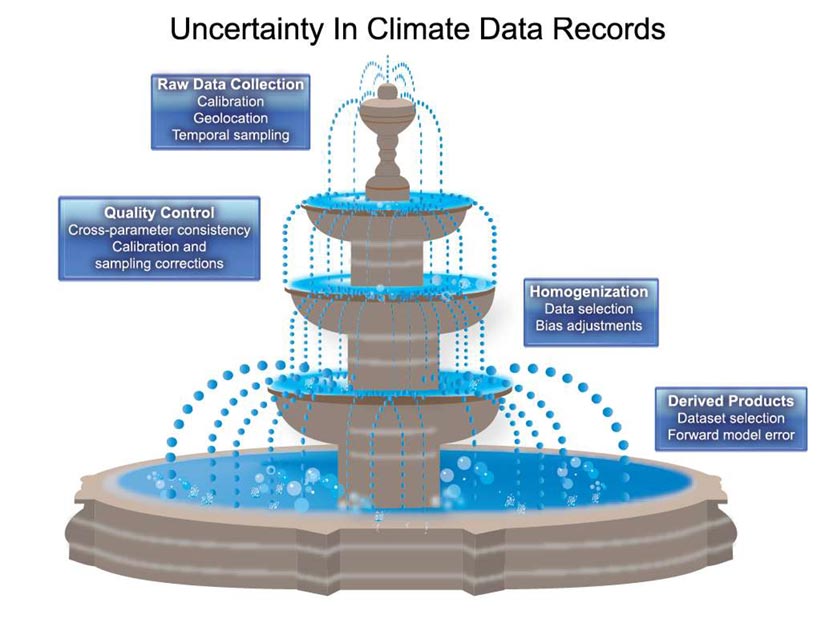
Uncertainty Quantification
Policy makers rely on climate observations and model predictions that inherently contain uncertainties. Accurate characterization of these uncertainties is necessary to make well-informed decisions. Observations…
Feb 2013
Developing Applications for the Energy Sector
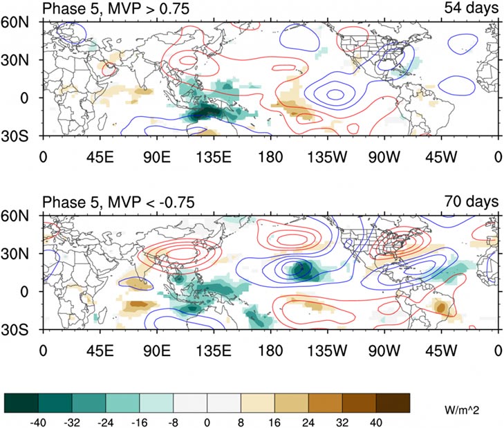
Satellite proxies for tropical rainfall (shaded) can identify changes in the global circulation (contours). These patterns help the energy sector anticipate changes in demand over…

