Search Results for: 搜索引擎抓取不到frame的内容,sql查询工具,bing map app咨询邮箱:lgooxc@qq.com
Jun 6, 2017
Eclipse Viewability Map
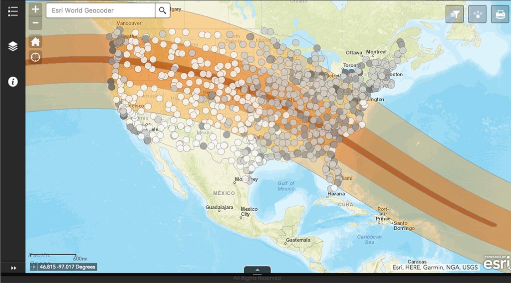
On August 21, 2017, a total solar eclipse will sweep across the continental United States, starting in the Pacific Northwest at around 9am Pacific Daylight…→
Oct 12, 2016
CICS at Fall AGU 2015
CICS at Fall AGU 2015 Attending/Presenting Kenneth Kunkel “IN14A-04: Data Management and the National Climate Assessment: Best Practices, Lessons Learned, and Future Applications: A Data…→
Jul 26, 2017
Cloudy skies could ruin your solar eclipse plans — Use this map to see how cloudy your Georgia city will be
Atlanta Journal-Constitution→
Feb 21, 2024
Map Reveals Best Locations to View Solar Eclipse Across U.S.
Newsweek. Benjamin Lynch.→
Feb 13, 2024
Will you get a clear view of the 2024 eclipse? See the cloudiness map.
Fox 59, Indianapolis, IN. Jeremy Tanner.→
Oct 12, 2016
2016 American Meteorological Society Annual Meeting
CICS-NC at the 2016 American Meteorological Society Annual Meeting The American Meteorological Society’s 2016 annual meeting takes place January 9–14 in New Orleans, Louisiana, and…→
Dec 13, 2013
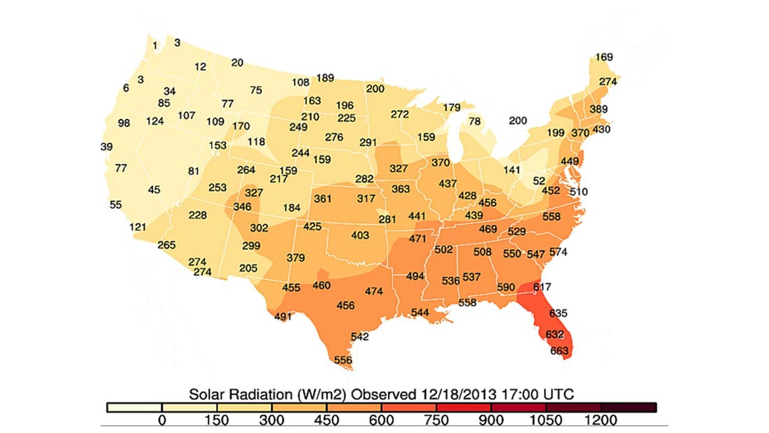
CICS-NC Develops An Interactive Map To Engage With NOAA Climate Data Users
The U.S. Climate Reference Network (USCRN) is a network of climate monitoring stations maintained and operated by NOAA to provide climate-science-quality measurements of air temperature…→
May 5, 2021
Exploring the New (Climate) Normal
NCICS’s Jared Rennie is exploring what NOAA NCEI’s new U.S. Climate Normals reveal about how our climate is changing across the United States. On May…→
Jul 26, 2016
Publications
2024 2023 2022 2021 2020 2019 2018 2017 2016 2015 2014 2013 2012 2011 2010 2009 2024 Anheuser, J., Y. Liu, and J. Key, 2024:…→