Search Results for: weizhuo004.cloud
Dec 20, 2019
NOAA Announces New Agreements with Cloud Data Providers
CISESS Continues as NOAA Big Data Project Data Broker Building on the success of the Big Data Project, NOAA announces new collaborative agreements with Amazon…→
Sep 27, 2017
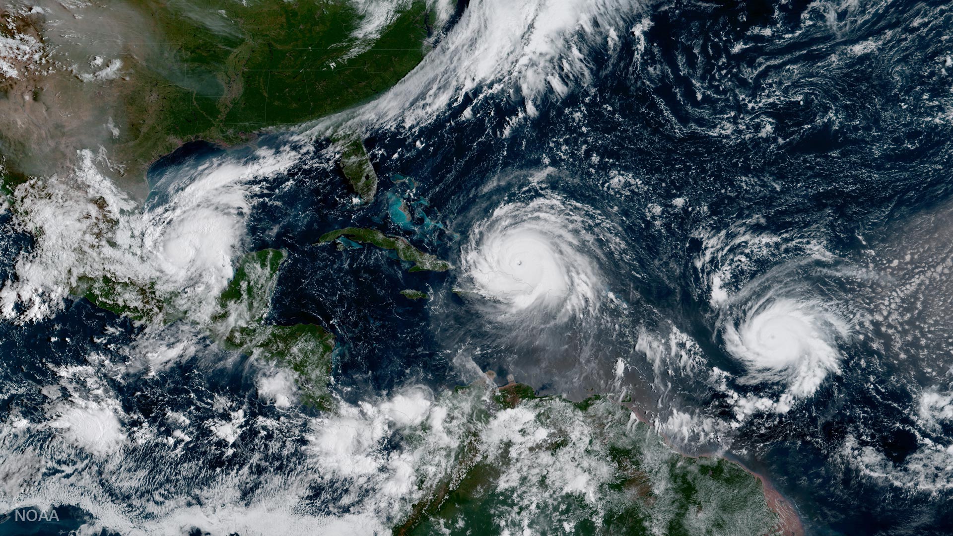
GOES-16 Data in the Cloud
NOAA’s new geostationary weather satellite, GOES-16, is already changing the way we view our planet, even though it won’t be declared fully operational until later…→
Jan 25, 2018
NOAA Big Data Program
Overview and NCICS/CISESS Contributions NOAA’s Big Data Program (BDP) is designed to facilitate public use of key environmental datasets by providing copies of NOAA’s information…→
Aug 8, 2017
Updated International Satellite Cloud Climatology Project (ISCCP) Data
NOAA’s National Centers for Environmental Information recently announced the release of an updated version of the International Satellite Cloud Climatology Project (ISCCP) dataset. ISCCP uses…→

Jonathan Brannock
Jonathan Brannock joined NCICS in March 2012 and is NCICS's information technology support specialist, responsible for design and support of all information technology infrastructure associated…→

Anand Inamdar
Dr. Anand Inamdar is a Research Scholar with NCICS. Since joining NCICS in 2010, Dr. Inamdar has worked on several projects, including calibration of the…→
Oct 11, 2016
Agenda
Home Abstract Registration Form Hotel Agenda Travel Food About Asheville NOAA/NESDIS Cooperative Research Program (CoRP) Using Satellite Observations and Models to Understand and Communicate Information…→
Dec 22, 2020
Climate Informatics 2022 - Agenda
Home Agenda Invited Speakers Paper Submission Registration Hackathon Travel & Lodging Organizing Committee Agenda Hackathon (hybrid): 9 May (afternoon) – 10 May (morning) Main conference: 10…→
Jul 26, 2016
Publications
2024 2023 2022 2021 2020 2019 2018 2017 2016 2015 2014 2013 2012 2011 2010 2009 2024 Anheuser, J., Y. Liu, and J. Key, 2024:…→
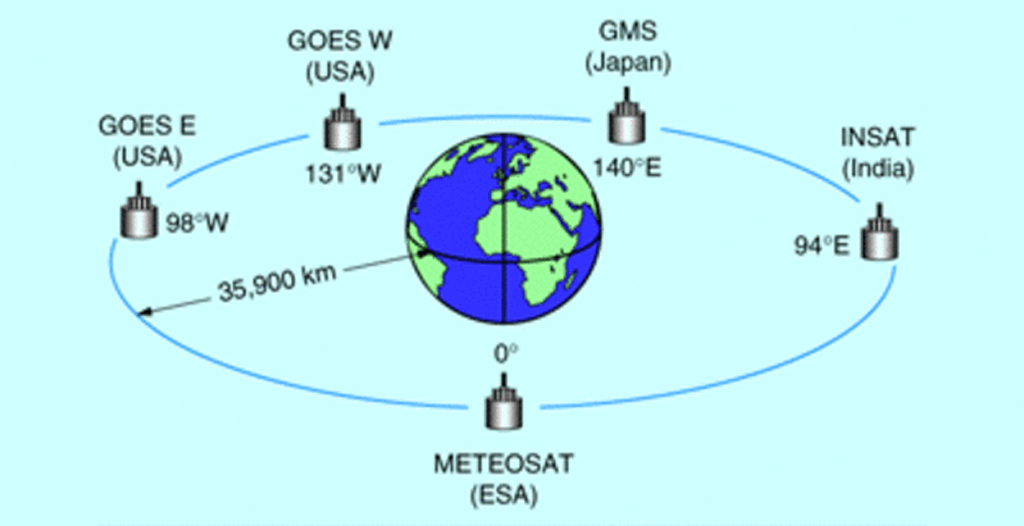
Apr 16, 2013
Calibration and Validation of Geostationary Satellite Visible Imagery
Meteorological satellites operating in geostationary orbits around the Earth (Fig. 1) provide us with observations of the Earth’s surface and clouds since the early 1970’s.…→