Search Results for: %22remote sensing%22
Oct 13, 2016
Speakers
Home Agenda Registration Form Speakers Hotel Travel Food About Asheville DR. ANTHONY ARGUEZ Anthony Arguez is a research climatologist at NOAA's National Centers for Environmental…→
Jul 13, 2015
Calibrating Satellite Data to Better Understand Clouds
The International Satellite Cloud Climatology Project (ISCCP) collects and analyzes satellite data in order to advance our understanding of clouds—how they are distributed around the…→
Oct 29, 2014
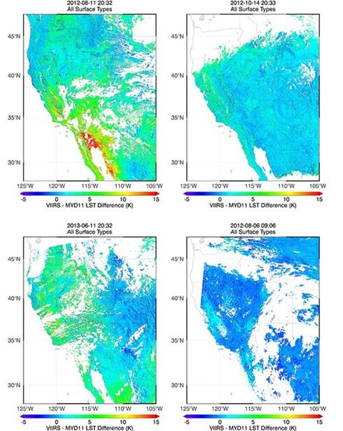
Validation of Land Surface Temperature products derived from the Visible Infrared Imaging Radiometer
Satellites provide critical weather and climate data, including measurements of surface temperature, but extracting temperature information from raw satellite data requires sophisticated data-processing algorithms. Jim…→
Oct 1, 2013
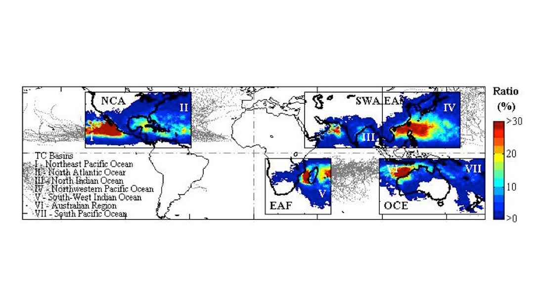
Quantifying Tropical Cyclone Rainfall
Tropical cyclones (TCs) constitute one of the major natural disasters around the world as well as an important source of fresh water over areas prone…→
Apr 19, 2013
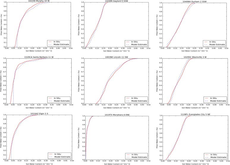
Evaluation and Characterization of Satellite Products
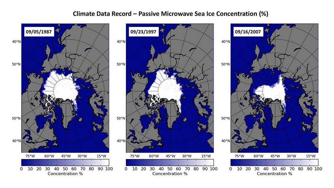
With the substantial change in the Arctic sea ice and associated impacts of the change in weather and climate system, ecosystems, and coastal communities, it…→
Apr 19, 2013
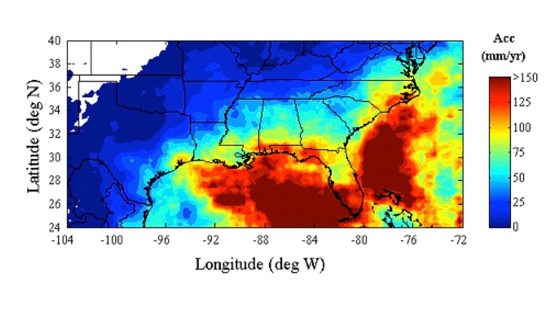
Quantitative Precipitation Estimates for the SE US
The precipitation climatology of the Southeastern United States spans a very broad spectrum of precipitation regimes. A warm season that is characterized by isolated thunderstorms,…→
Sep 1, 2016
Obs4MIPS: Connecting Models and Observations
A key part of the validation and assessment of any climate model is to start the model at some time in the past, run it…→