NCICS News
Jan 1, 2016
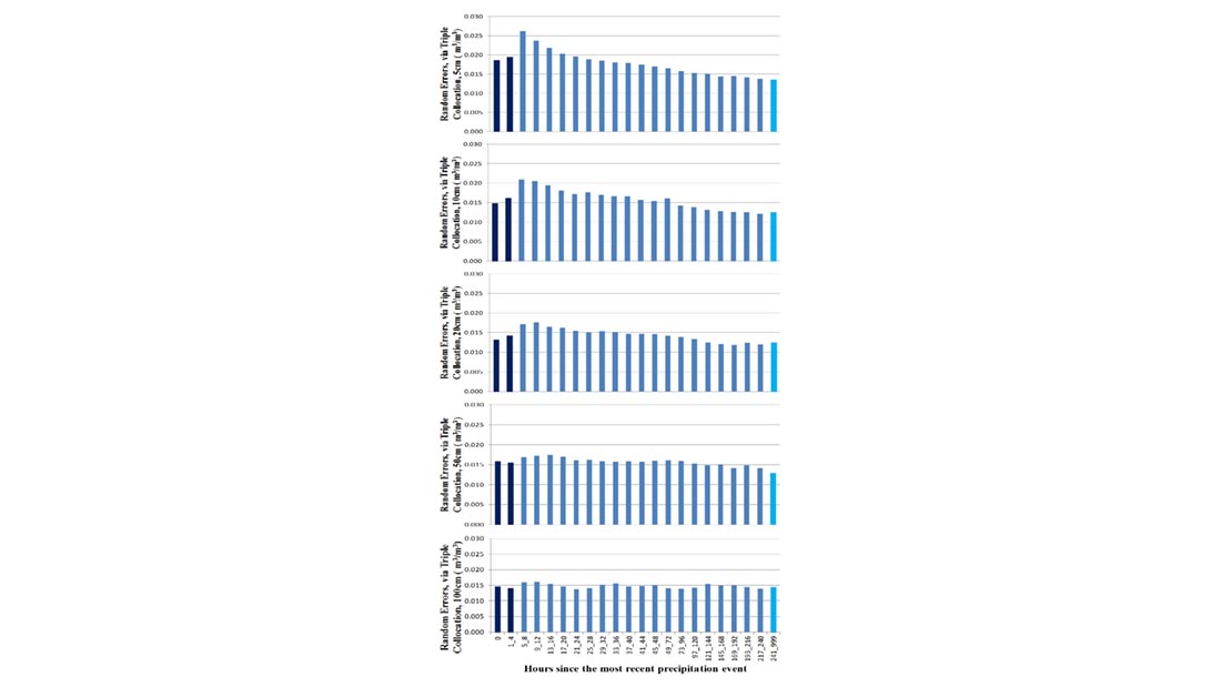
Multi-Profile Analysis of Soil Moisture within the US Climate Reference Network
CICS-NC’s Jesse Bell is a coauthor on a new analysis of U.S. Climate Reference Network (USCRN) measurements of soil moisture, published in Vadose Zone Journal.…
Dec 18, 2015
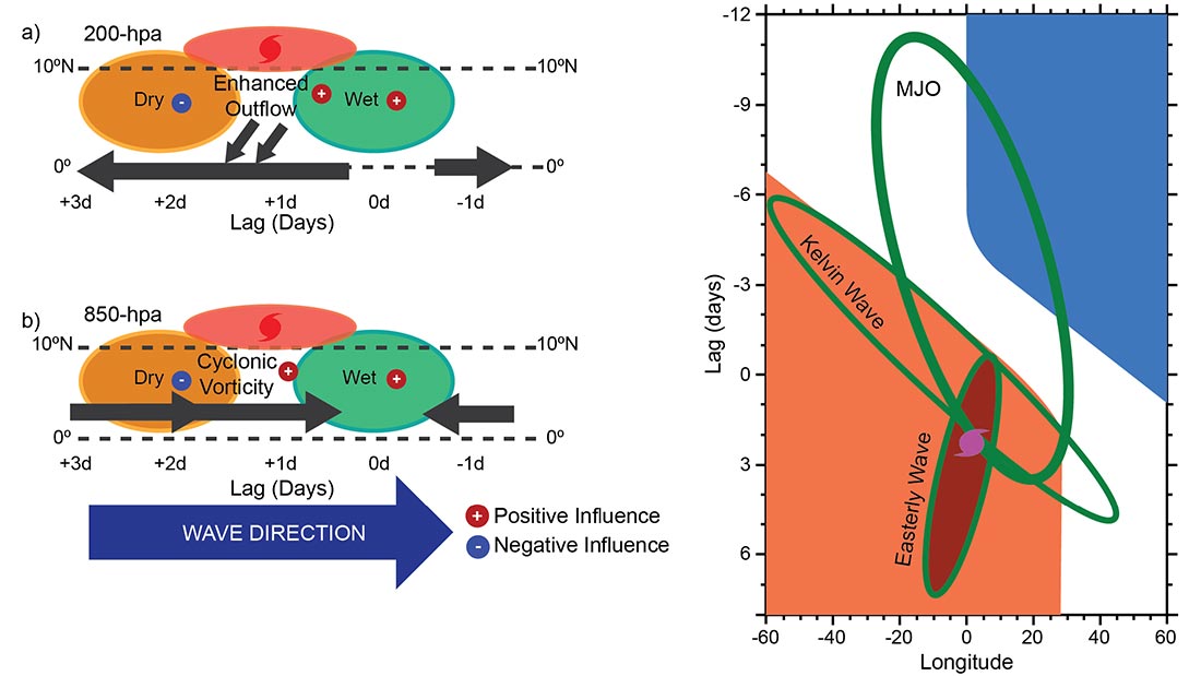
Kelvin Waves and Tropical Cyclogenesis: A Global Survey
A new study by Carl Schreck III of the North Carolina Institute for Climate Studies and North Carolina State University provides important insights into the…
Dec 14, 2015
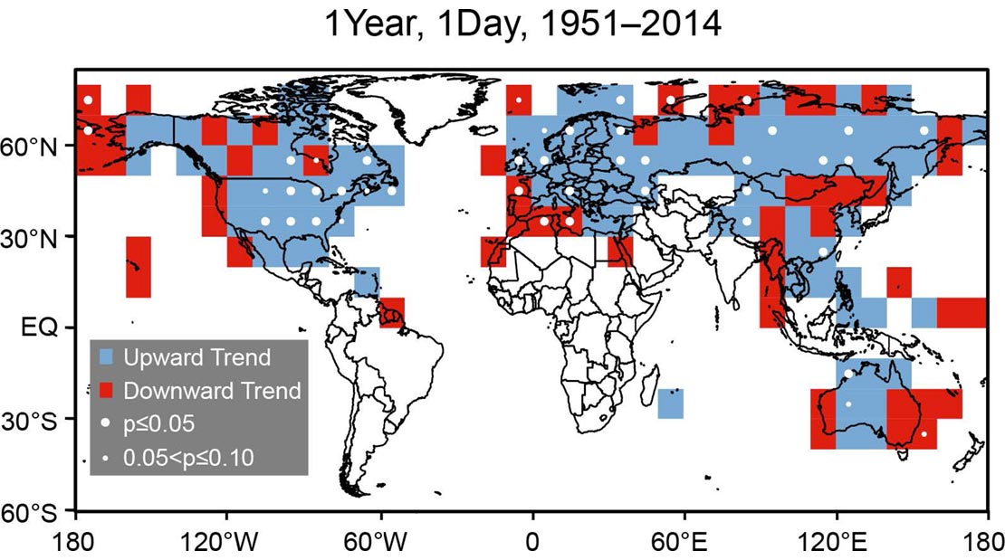
Global Land Surface Extremes of Precipitation
In an article published in the Journal of Extreme Events, CICS-NC’s Kenneth Kunkel and Rebekah Frankson analyze trends in heavy precipitation events and their relationships…
Nov 14, 2015
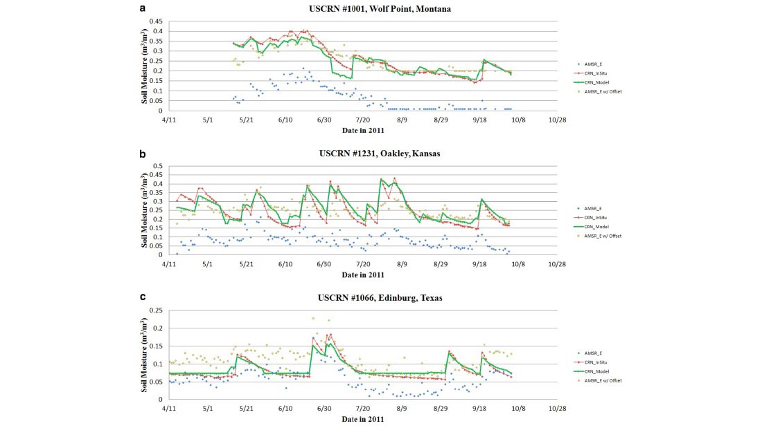
Comparing AMSR-E Soil Moisture Estimates to the Extended Record of the U.S. Climate Reference Network (USCRN)
Building on previous work by the same author team, a paper in Advances in Water Resources reports on the use of satellite data to validate…
Oct 9, 2015
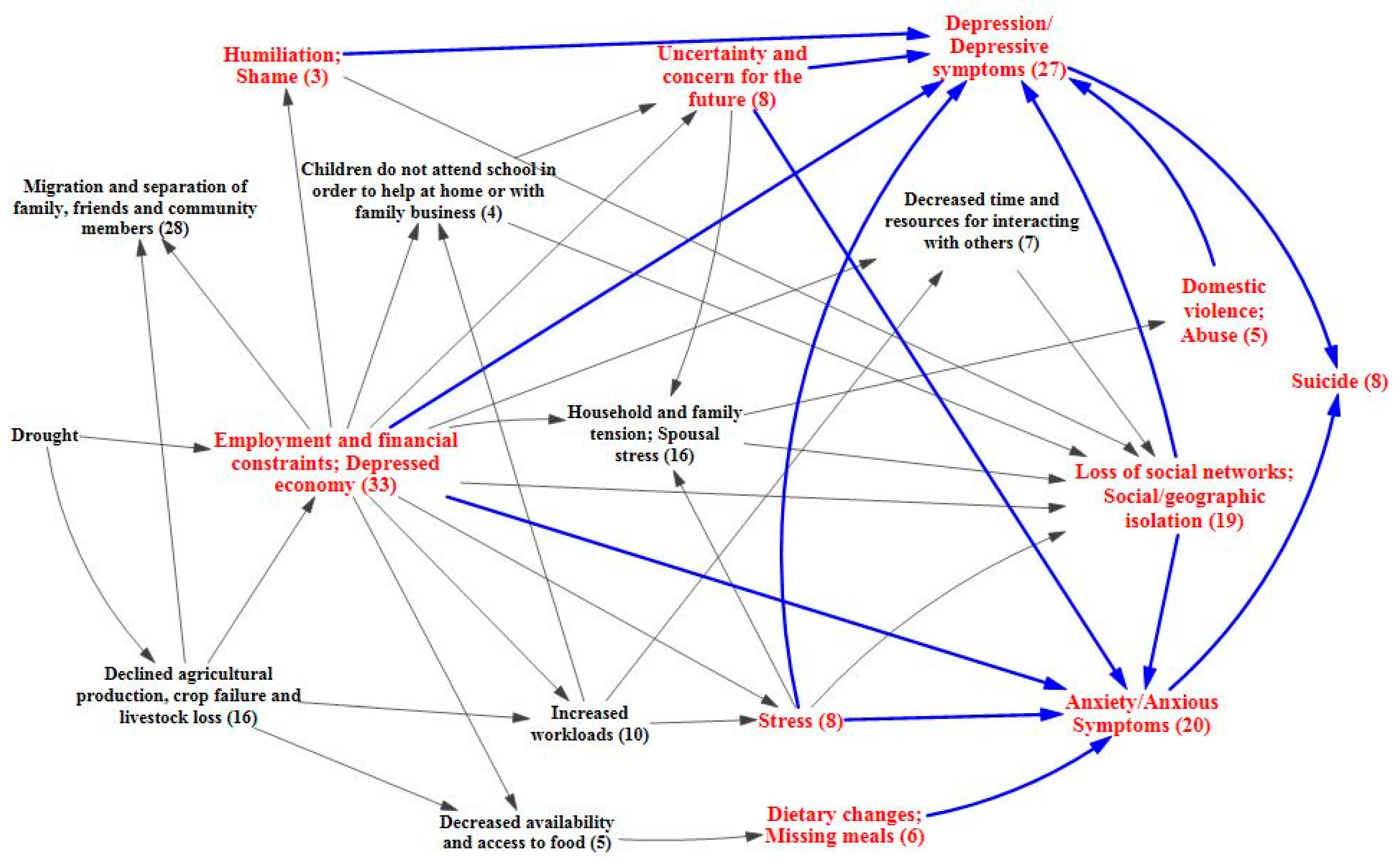
The Mental Health Outcomes of Drought: A Systematic Review and Causal Process Diagram
Working with colleagues at Emory University, CICS-NC’s Jesse Bell contributed to a recent paper on the impacts of drought on mental health. After performing a…
Oct 9, 2015
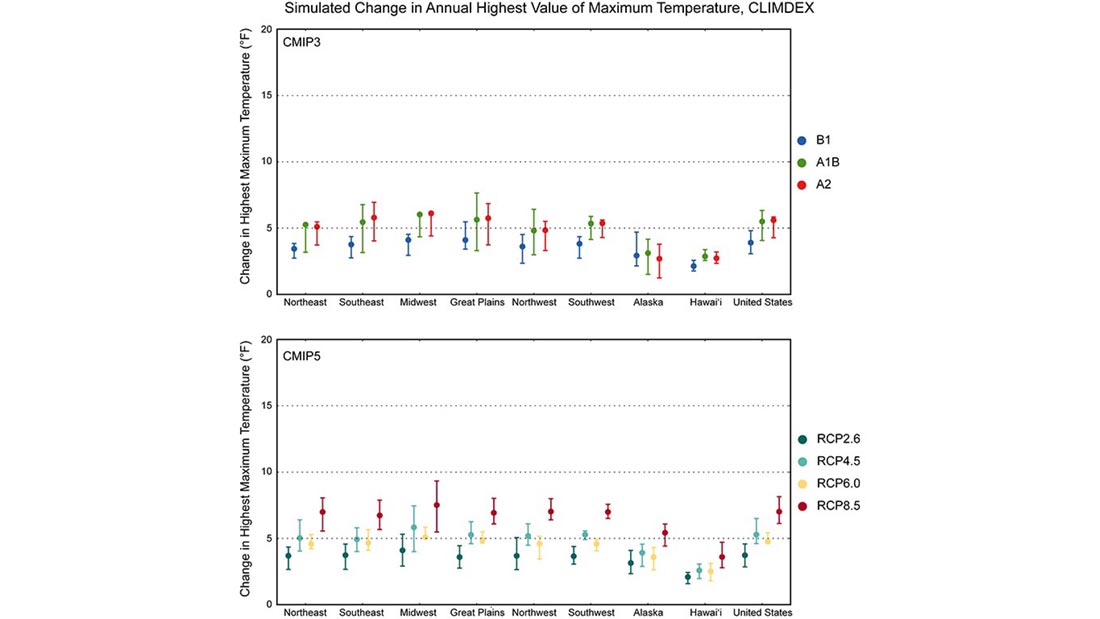
Comparing CMIP3 and CMIP5 Climate Simulations
The National Oceanic and Atmospheric Administration (NOAA) has released a new report comparing results for the United States from two generations of climate model simulations.…
Oct 1, 2015
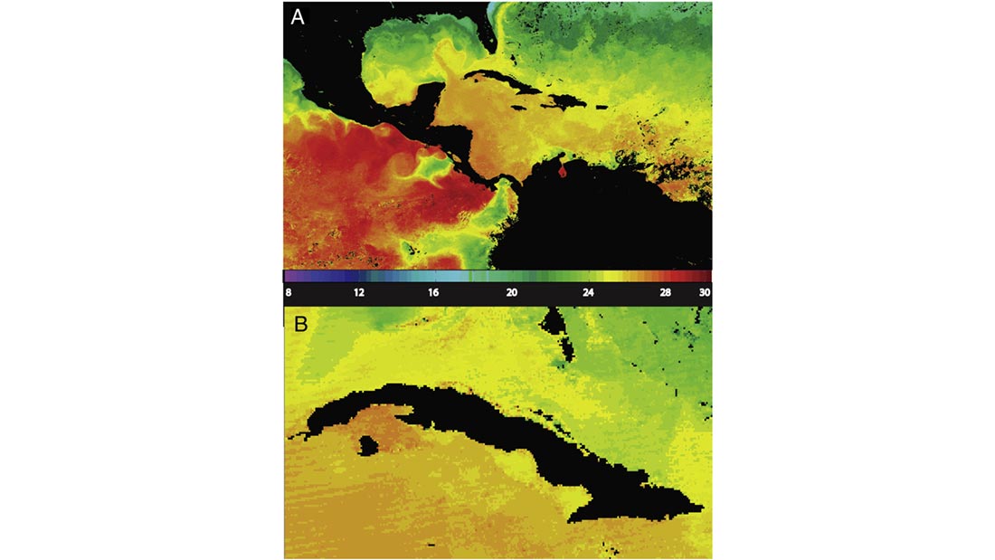
MODIS: A Decade of Sea Surface Temperatures
Satellite-based instruments are the best tools we have for measuring sea surface temperatures (SSTs) on a global scale, but turning infrared sensor data into accurate…
Sep 8, 2015
New Executive Director of American Association of State Climatologists
The Cooperative Institute for Climate and Satellites–North Carolina (CICS-NC) welcomes retired Air Force Lieutenant Colonel Glenn Kerr as the first full-time Executive Director of the…
Aug 25, 2015
Asheville Selected for U.S. Climate Organization's National Office
The American Association of State Climatologists (AASC) and the Economic Development Coalition for Asheville-Buncombe County (EDC) announced today that the AASC will locate its headquarters…
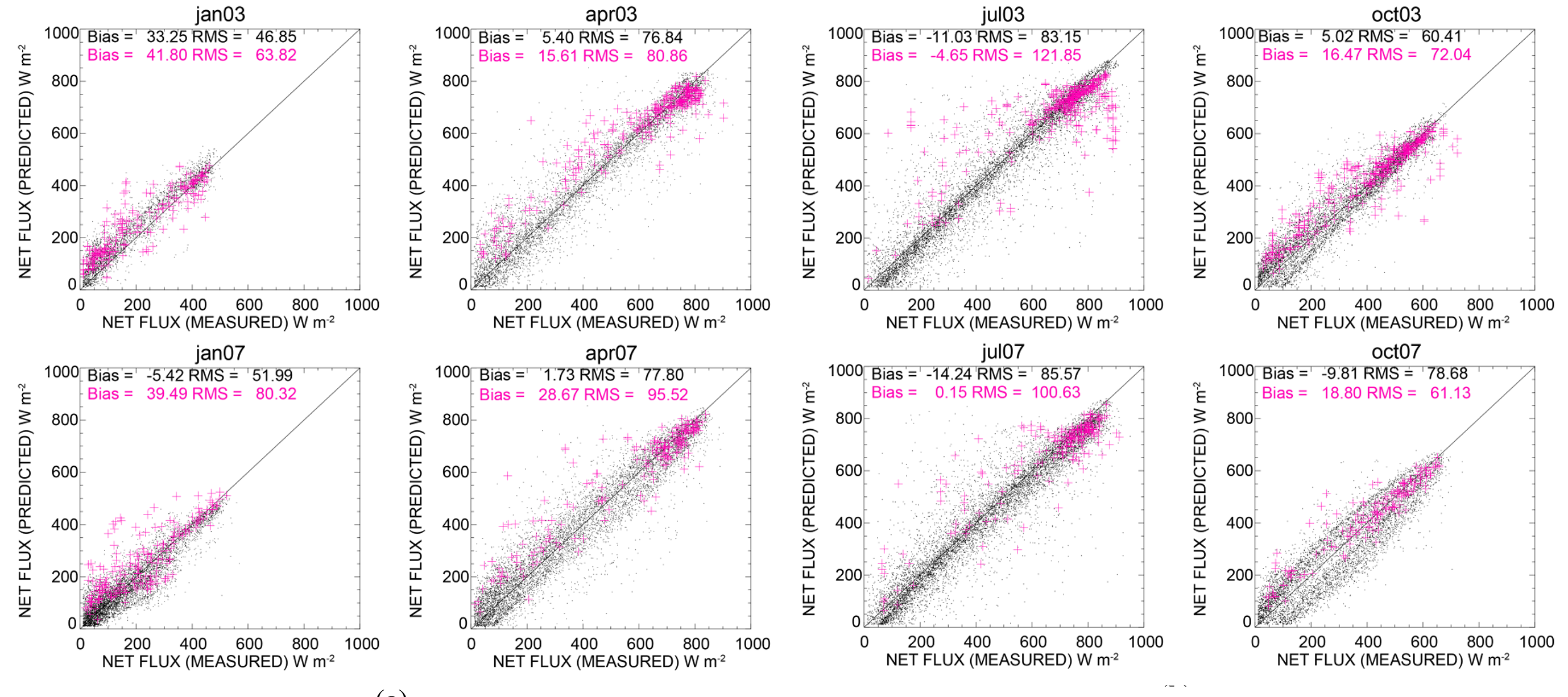
Aug 21, 2015
Net Surface Shortwave Radiation from GOES Imagery—Product Evaluation Using Ground-Based Measurements from SURFRAD
The balance of incoming and outgoing radiation at the Earth’s surface plays a crucial role in how energy and water is exchanged between the surface…