Search Results for: 必应地图实例咨询QQ:50317349 乌兰浩特澳大利亚的搜索引擎,http www.yahoo.cn
Oct 9, 2015
Comparing CMIP3 and CMIP5 Climate Simulations
The National Oceanic and Atmospheric Administration (NOAA) has released a new report comparing results for the United States from two generations of climate model simulations.…→
Oct 1, 2015
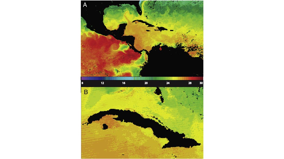
MODIS: A Decade of Sea Surface Temperatures
Satellite-based instruments are the best tools we have for measuring sea surface temperatures (SSTs) on a global scale, but turning infrared sensor data into accurate…→

Jan 13, 2022
Open Climate Data Workshop 2022
Interested in using data to help address climate challenges in North Carolina? If so, please join us at the virtual Open Climate Data Science Workshop…→
Jul 31, 2017
Will it be cloudy on Aug. 21 for the total solar eclipse?
WKRN, Nashville, TN→
Jul 16, 2015
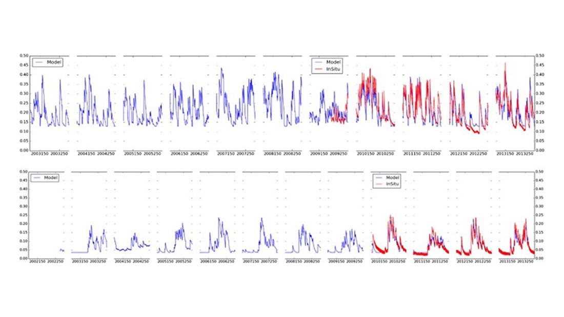
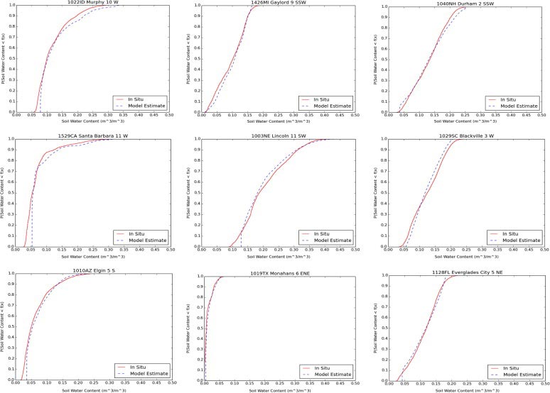
Extending the Soil Moisture Record
Long-term data on soil moisture can be invaluable for making decisions about agricultural irrigation, understanding and predicting drought, and improving global climate models. Unfortunately, accurate…→
Jul 13, 2015
Calibrating Satellite Data to Better Understand Clouds
The International Satellite Cloud Climatology Project (ISCCP) collects and analyzes satellite data in order to advance our understanding of clouds—how they are distributed around the…→
Apr 10, 2015
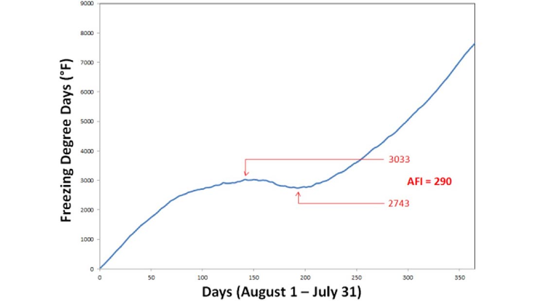
Winter Severity and Frost Depth in a Warming Climate
In many areas of the country, proper building design and construction depend on accurate expectations of how deeply the ground will freeze in the winter.…→
Feb 9, 2015
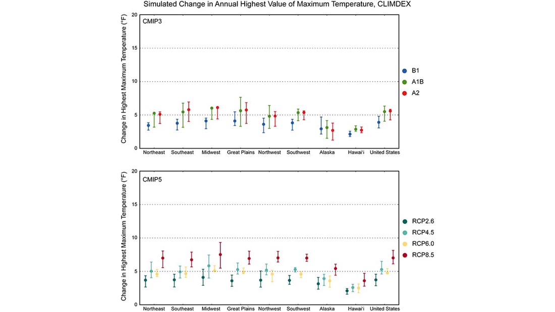
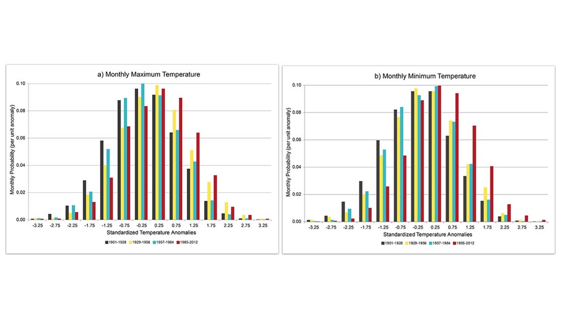
Temperature Extremes in a Warming Climate
We know that global and national average temperatures have been increasing since around the start of the 20th century. But have there also been increases…→
Oct 29, 2014
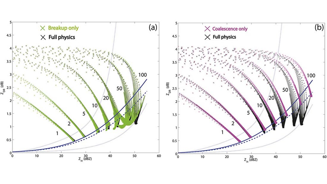
The Impact of Raindrop Collisional Processes on the Polarimetric Radar Variables
Olivier Prat of CICS-NC and co-author Matthew Kumjian recently examined the complex, very small-scale processes of rainfall by combining model simulations of rainfall microphysics with…→
